discover.swiss ID
osm_1684063
discover.swiss Additional Type
City

Enduro-Tour Brambrüesch - Passugg
Medium
10.9 km
1:00 h
17 mhd
1006 mhd
Trail zwischen Malix und Passugg

Show all 5 images

Pause beim Sirupbrunnen in Spina
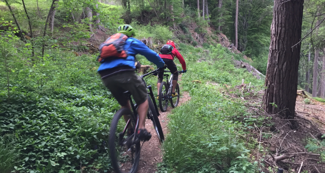
Single trail descent from Chur's local mountain to Malix, Passugg and back to Chur.
Technique 3/6
Fitness 2/6
Highest Point  1605 m
Lowest Point  599 m
Best Season
Jan
Feb
Mär
Apr
Mai
Jun
Jul
Aug
Sep
Okt
Nov
Dez
Start
Brambrüesch, top station of gondola
Destination
Chur, valley station of gondola
Coordinates
46.829109, 9.516378

Details

Description

Start of the tour at the top station of the Chur cableways at Brambrüesch. First follow the signposted route no. 616 (Biketicket 2 RIDE red), but at Spina turn left towards Malix - and refresh yourself first at the syrup fountain! After a stretch on the road follows a steep trail that leads into the Passugger Gorge. Finally, there is another single track taking you back to Chur.

Directions

Public Transport

Take the train to Chur station. From there you can reach the valley station by bike in 5 minutes.

Anreise Information

  • Highway exit Chur Süd

  • Drive in direction of the city centre (Kasernenstrasse)

  • The valley station and parking lot are located in front of the city centre on the right-hand side.

Parking

More about parking for guests of the Chur mountain railways.

Responsible for this content Brambrüesch.
This content has been translated automatically.

Walking tour through the Alpine City

Simple
4.5 km
1:45 h
20 mhd
20 mhd
City E-Guide Chur
Blick auf die Churer Altstadt

Show all 14 images

Arcas Platz in der Altstadt
Discover Switzerland's oldest town on a tour through the city center and the historic Old town. In addition with the Audio Guide from Chur Tourism, you will enjoy an interesting and individual city tour.
Technique 1/6
Fitness 1/6
Highest Point  623 m
Lowest Point  574 m
Best Season
Jan
Feb
Mär
Apr
Mai
Jun
Jul
Aug
Sep
Okt
Nov
Dez
Start
Chur, train station
Destination
Chur, train station
Coordinates
46.853748, 9.529188

Details

Description

The City E-Guide by Chur Tourism is the individual city tour for your mobile phone or tablet. With the free app, you can explore the city on your own. All kinds of interesting facts about history, culture, sights and much more are available in the app at any time. You can choose from various tours of different lengths, which can be adapted to your starting point thanks to GPS positioning.

In 43 chapters you will learn many interesting facts about the history and culture of the Alpine City of Chur and the holiday canton of Graubünden. A further 32 chapters deal with the Cathedral Treasure Museum of the Diocese of Chur - you will learn many interesting facts about the history of the diocese, about the cathedral treasure of Chur and the Death Pictures from the Episcopal Castle.

At the Tourist Info at Chur mainstation, you have also the possibility to rent a tablet with the City E-Guide on it. Thanks to the larger screen, tablets are ideal for experiencing the tours together with one device.  

Directions

Public Transport

The tour begins directly at the Chur railway station.

Responsible for this content Chur Tourism.

Alpenride (702)

Difficult
2 km
0:10 h
1 mhd
408 mhd
Alpenride Trail im Alpenbikepark Chur
Alpenride (702)

Show all 4 images

Drop-Batterie auf der roten Strecke
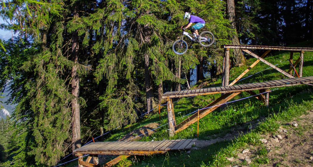
The Alpenride is a freeride trail in the upper section of the Alpenbikepark Chur.
Technique 3/6
Fitness 2/6
Highest Point  1593 m
Lowest Point  1184 m
Best Season
Jan
Feb
Mär
Apr
Mai
Jun
Jul
Aug
Sep
Okt
Nov
Dez
Start
Brambrüesch, top station of gondola
Destination
Känzeli, middle station of gondola
Coordinates
46.829463, 9.516248

Details

Description

The Alpenride trail is a freeride classic with several jumps, drops and a good mix between easier and more difficult sections.

Directions

Public Transport

Take the train to Chur station. From there, the city bus (line 1) takes 3 minutes to the valley station of the mountain railways (Stadthalle/Brambrüeschbahn stop).

Anreise Information

  • Motorway exit Chur Süd
  • Drive into the city (Kasernenstrasse)
  • The valley station and car park are on the right-hand side in front of the town centre

Parking

More about parking for guests of the Chur mountain railways.

Responsible for this content Brambrüesch.
This content has been translated automatically.

Chur - Trimmis - Zizers - Haldenstein - Chur

Simple
26.4 km
2:15 h
139 mhd
139 mhd
Trimmiser Mittelweg
Trimmiser Mittelweg

Show all 7 images

Churer Rheinroute 501, Pardislabrücke Haldenstein-Chur
Beautiful round tour from Chur, connecting the two new cycle paths Chur-Trimmis and Haldenstein-Chur with the Rhine route.
Technique 1/6
Fitness 2/6
Highest Point  655 m
Lowest Point  539 m
Best Season
Jan
Feb
Mär
Apr
Mai
Jun
Jul
Aug
Sep
Okt
Nov
Dez
Start
Chur railway station
Destination
Chur railway station
Coordinates
46.85354, 9.529757

Details

Description

The Chur-Trimmis cycle path over the Trimmiser Mittelweg was opened on 27 November 2019. It leads from the end of the Cadonaustrasse in Chur to the Blutmarchweg in the Fürstenwald and over a new bridge at the Maschänserrüfe and the Trimmiser Mittelweg to Trimmis. The Haldenstein-Chur cycle path was opened on 14 December 2018. It leads from Haldenstein along the Rhine to the Pardisla bridge, which was newly built and crosses the Rhine in the direction of Chur.

The two new cycle paths can be combined in a round tour from Chur via Zizers to a beautiful round tour. Provided there is no snow all the way down to the valley, this route can be used practically all year round and is also suitable in winter as a round route for cyclists, cross-country bikers, e-bikers or gravel bikers. Between Trimmis and Zizers, the tour leads through the vineyard landscape and on to Molinära Hof over a piece of unpaved ground (hiking trail). If you prefer to do the whole round on a paved surface, you can go in Trimmis directly down to the Deutsche Strasse and along it to Zizers - so the round is even suitable for racing cyclists (a short section through the Fürstenwald on the new cycle path Chur-Trimmis runs on a not asphalted but paved forest path).

Responsible for this content Chur Tourism.

Fürhörnli

Geschlossen
Medium
35.8 km
5:50 h
1832 mhd
2730 mhd
Trail Tales: Fürhörnli – Über den Dächern von Chur
Fürhörnli

Show all 10 images

Fürhörnli
1,300m over the roofs of Graubünden’s capitol Chur, a summit register is waiting for the adventurous bikers entries. Add a detour over Chur’s mountain range to your lengthy tour and enjoy the mix of great views and magnificent trails.
Technique 4/6
Fitness 4/6
Highest Point  2025 m
Lowest Point  590 m
Best Season
Jan
Feb
Mär
Apr
Mai
Jun
Jul
Aug
Sep
Okt
Nov
Dez
Start
Parpan
Destination
Chur
Coordinates
46.760159, 9.557338

Details

Description

We will start our tour this morning in Parpan, gently beginning our ascent on asphalt roads until we reach Chur’s pass. The first descent starts here. The steep descent, full of roots, will definitely get your adrenaline flowing. The ride downhill is challenging but no match for bikers with good riding technique. The first descent ends in Chur.  

We take a little tour of the town by bike and fill our energy reserves in one of the town’s many restaurants. Now we’re ready for the second part of our tour. From Chur we climb to Fürhörnli. We can either bike the whole way up, or take the postbus as far as Maladers, which saves 400m of elevation. You might want to save your energy for later when the ascent up paved paths turns extremely steep.

The panorama from the top of Fürhörnli is breath-taking. The mountain face falls vertically and we have a fantastic view over the town and the Rhine Valley. As always, the best is saved for last – the trails that take you down 1,300m of elevation into Chur. ther bike the whole way up, or take the postbus as far as Maladers, which saves 400m of elevation. You might want to save your energy for later when the ascent up paved paths turns extremely steep.

Responsible for this content Graubünden Ferien.
This content has been translated automatically.

Red Plate

Medium
5.2 km
3:10 h
845 mhd
4 mhd
Aussicht von der Roten Platte
Markant: Die Rote Platte von unten gesehen

Show all 3 images

Rote Platte (oua_25695182_8f3ed42_profile)
Short but steep and challenging hike to the Red Plate with fantastic views.
Technique 4/6
Fitness 4/6
Highest Point  1507 m
Lowest Point  662 m
Best Season
Jan
Feb
Mär
Apr
Mai
Jun
Jul
Aug
Sep
Okt
Nov
Dez
Start
Fürstenwald, Chur
Destination
Fürstenwald, Chur
Coordinates
46.870169, 9.543997

Details

Description

The starting point of the hike is at the Fürstenwald, which can be easily reached with the city bus line 2 out of the city. The hike first follows the wide forest road towards Mittenberg. About halfway through, the hiking trail branches off to the left to the Red Plate. The path becomes a trail and you dive deeper into the forest. Finally, you can see the Red Plate from below, before the steep ascent up there. The ascent can be quite slippery after rain or snow.  The final ascent to the summit as well as the summit itself is exposed and only recommended for sure-footed hikers with a head for heights. The view from the summit of Chur and the Rhine Valley, however, is simply breathtaking. The descent follows the same route as the ascent. 

Directions

Public Transport

Start at the stop Fürstenwald (line 2 of the city bus Chur)

Parking

Parking at Fürstenwald

Responsible for this content Chur Tourism.
This content has been translated automatically.

Tschiertschen - Grida - Chur (10)

Geschlossen
9.8 km
3:15 h
109 mhd
846 mhd
Dominic Frei
Tschiertschen - Grida - Chur (10) (oua_49811119_1e457eb_profile)
Leisurely hike from Tschiertschen via Passugg, down to Chur - over hill and dale off the cantonal road
Technique 0/6
Fitness 0/6
Highest Point  1338 m
Lowest Point  600 m
Best Season
Jan
Feb
Mär
Apr
Mai
Jun
Jul
Aug
Sep
Okt
Nov
Dez
Coordinates
46.818241, 9.606541

Details

Description

From the village centre (1343 m above sea level) M) as on Route 9 via the car park at the entrance to the village, «Fraumatten» and «Usser Praden» (1160 m.a.s.l. M) to the fork in the path before the "Steinbachtobel", where the path to Runcalier–Churwalden branches off to the left. Here you turn right, cross the "Steinbachtobel" after a short descent and traverse the steep slope to the ravine on a narrow footpath. This passage requires careful walking, especially in wet weather! Via the mountain hut "Ricaldei" (1136 m.a.s.l. M) you soon reach the road (1146 m.a.s.l. M), over which you can now comfortably descend to "Grida". Here you leave the road to the left and hike via "Obergrida" (982 m above sea level). M) and «Untergrida» (942 m above sea level). M) along a footpath through meadows steeply to "Passugg Alte Post" (770 m above sea level). M). From here, it is recommended to take the path via "Meiersboden" and then hike above the "Rabiusa" to reach the outskirts of Chur.

Responsible for this content Info Tschiertschen-Praden.
This content has been translated automatically.

CampAu Family tour

Simple
22.6 km
1:30 h
135 mhd
135 mhd
CampAu am Rhein-Ufer
Blick auf Reichenau-Tamins und das Churer Rheintal

Show all 4 images

Restaurant beim CampAu
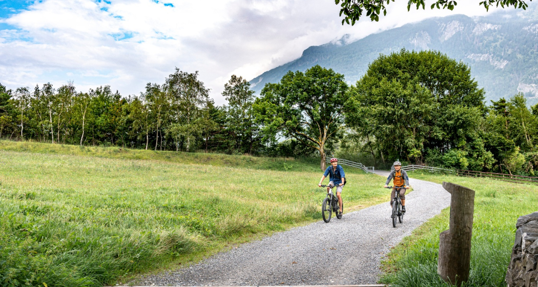
Pleasant family cycling tour at the border of the Rhine river through the villages of the Chur Rhine valley.
Technique 1/6
Fitness 1/6
Highest Point  662 m
Lowest Point  557 m
Best Season
Jan
Feb
Mär
Apr
Mai
Jun
Jul
Aug
Sep
Okt
Nov
Dez
Start
Chur, Campsite Au
Destination
Chur, Campsite Au
Coordinates
46.861849, 9.507594

Details

Description

Start your tour at the campsite Obere Au. Cycle along the Rhine river to the village of Felsberg (in case the path is closed due to military exercises in this area, you can follow the official cycling route no. 2 and 6). The tour takes you then through the villages of Felsberg, Tamins, Reichenau, Domat/Ems and back to Felsberg and Chur. The campsite Obere Au has a playground for children and a restaurant, where you can have a meal and drinks.

Responsible for this content Chur Tourism.

Domleschger Loop

Simple
56.2 km
3:00 h
386 mhd
386 mhd
Schloss Ortenstein
Churer Rheintal

Show all 5 images

Schloss Rhäzüns
Domleschger Loop
Technique /6
Fitness 2/6
Highest Point  777 m
Lowest Point  561 m
Best Season
Jan
Feb
Mär
Apr
Mai
Jun
Jul
Aug
Sep
Okt
Nov
Dez
Start
Chur, Obere Au
Destination
Chur, Obere Au
Coordinates
46.854236, 9.50527

Details

Description

The perfect after-work tour: This mostly flat round trip leads from Chur via the Chur Rhine Valley through the picturesque Domleschg.  Most of the journey leads through gentle hilly landscapes, past wonderful orchards and imposing castles and palaces.

Responsible for this content Chur Tourism.
This content has been translated automatically.

Calanda (hut) round tour

Difficult
23.1 km
7:00 h
1530 mhd
1530 mhd
Tiefblick auf die Stadt Chur
Weit oberhalb der Alpenstadt Chur

Show all 8 images

Blick vom Rossboden auf den Felsberger Calanda
Beautiful round tour from Haldenstein to the Calanda hut und back to Chur. Recommended with overnight in the hut and additional ascent to the Calanda peak.
Technique 3/6
Fitness 5/6
Highest Point  2083 m
Lowest Point  562 m
Best Season
Jan
Feb
Mär
Apr
Mai
Jun
Jul
Aug
Sep
Okt
Nov
Dez
Start
Haldenstein, bus stop in the village
Destination
Chur, bus stop Obere Au
Coordinates
46.878781, 9.526922

Details

Description

The Chur city bus no. 3 takes you to the starting point in the village of Haldenstein. Follow the well-marked path to the Calanda mountain hut. On the way up, you will pass by the alps of Arella and Nesselböden. Continuously walking up-wards you will reach the alp Altsäss. From there it's just 100 meters in height to the Calanda hut (2073 m.).

The optional, but well worth ascent to the Calanda peak (Haldensteiner Calanda, 2'805 m) means an additional 730 meters of height difference and appr. 2 hours walking time. Recommended with overnight in the Calanda hut and ascent at sunrise. On the Calanda peak you will enjoy fantastic panorama views. If you just walk as far as the Calanda hut, you can enjoy some food and drinks there before the way back.

For the descent walk southwards along to the Felsberger Älpli. The descent to Felsberg is leisurely at first, but continuously getting steeper while descending. Leave the village of Felsberg on the right hand side and follow the Rhine river for a short distance. After crossing the Rhine river walk through the Rossboden and at the P & R parking area Obere Au you can take the bus back into the city.

Responsible for this content Chur Tourism.