Geschlossen
Simple
45 km
4:30 h
460 mhd
2900 mhd
615 Biketicket to ride blau

Show all 7 images

615 Biketicket to ride blau
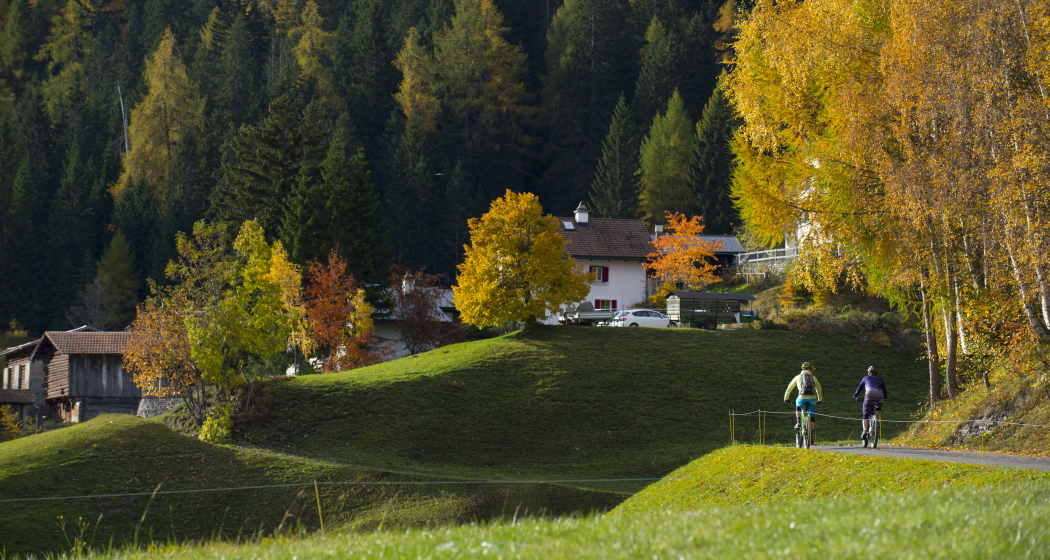
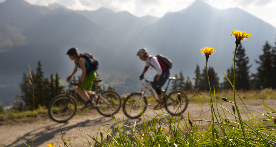
For a leisurely ride and for families this round tour through idyllic countryside offers a lot of fun! With pleasant and gentle declines and slight ascents, this route is suitable even for bikes without extra suspension.
Technique /6
Fitness 4/6
Highest Point   m
Lowest Point   m
Best Season
Jan
Feb
Mär
Apr
Mai
Jun
Jul
Aug
Sep
Okt
Nov
Dez
Start
Lenzerheide
Destination
Lenzerheide
Coordinates
46.72715139073, 9.5578329519424

Details

Description

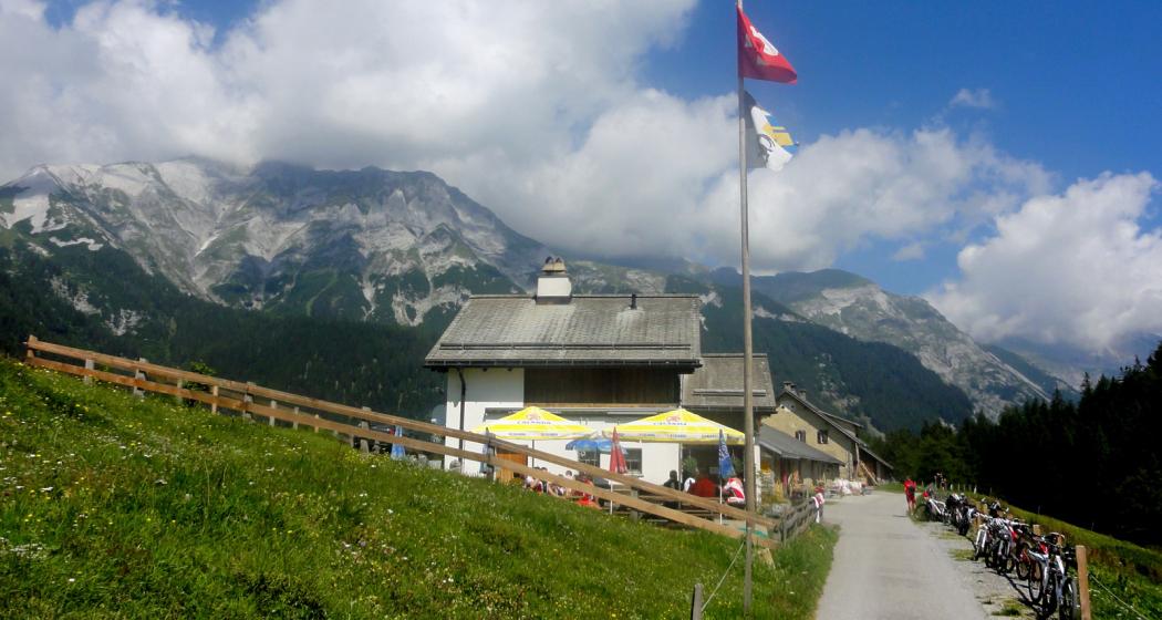
Taking the Tgantieni chairlift, the first step of the tour is comfortably begun. Above lies the alpine path, going to the Tgantieni Mountain Hotel and then further onto the Bergbeizli (small mountain pub) Spoina. The first part runs over well-prepared forest roads with occasional glimpses of Lenzerheide and Heid lake. The gentle descent passes the Valbella hostel and goes through Parpan village back to Churwalden.

A further nature trail brings you to Passugg, which is the source of a famous mineral water. The roaring creek Rabiosa, in Romansch «The Raging», cuts its way through the Passugg gorge. In 1863 this spring was rediscovered, which is known today throughout Switzerland as the mineral springs of Passugg. Next you drop down to Chur and take the gondola back up to Brambrüesch. From here descend again on a tarmac surface to Churwalden, where you take the chairlift Heidbüel.

Sicherheitshinweis

Attention:

- The Tgantieni and Scalottas chairlifts do not transport downhill bikes (double bridge fork)!

- Please note the respective operating times as well as the transport criteria before you start the tour. You can find more information here.

Ausrüstung

Protector jackets and full-face helmets are also prohibited. Normal helmets, knee and elbow protectors are permitted.

Directions

This route is only signposted in one direction: Lenzerheide-Tgantieni-Churwalden-Brambrüesch-Chruwalden-Alp Stätz-Lenzerheide

Directions

Public Transport

Travel by train to Chur, then transfer directly to the Postauto Graubünden buses to reach Lenzerheide within 30 minutes.

Anreise Information

Von Basel und Zürich - Chur-Süd (Ausfahrt Nr. 17) - Lenzerheide.

Von Milano - Lugano - San-Bernadino-Tunnel - Thusis - Chur (Ausfahrt Lenzerheide) - Lenzerheide.

Parking

Parking: Julier Parkplatz, Parkplatz Rothorn oder Parkplatz Tgantieni

Responsible for this content Graubünden Ferien.

Rhine Gorge Railway Hike: Reichenau - Trin Station

Geschlossen
Simple
4.9 km
1:15 h
17 mhd
13 mhd
Wandersteg am Rhein
Blick auf Reichenau-Tamins und das Churer Rheintal

Show all 7 images

Ausblick auf den Rhein und den Wanderweg
A rewarding, easy hike along the Rhine Gorge from Reichenau to Trin Station.
Technique /6
Fitness 1/6
Highest Point  608 m
Lowest Point  591 m
Best Season
Jan
Feb
Mär
Apr
Mai
Jun
Jul
Aug
Sep
Okt
Nov
Dez
Start
Reichenau railway station
Destination
Trin railway station
Coordinates
46.823889, 9.412874

Details

Description

The hike starts at Reichenau railway station, where you first cross the confluence of the Vorderrhein and Hinterrhein rivers and then walk along the Vorderrhein to Trin Station. After an initial stretch through the village, a beautiful hiking trail follows, always along the Rhine. In between there are always beautiful vantage points and good opportunities for breaks or barbecues. The hike is also ideal for families with small children, who can already hike on their own or are otherwise carried in a carry backpack (but not recommended for prams). At Trin Station you can optionally cross the Rhine on the suspension bridge.

Responsible for this content Chur Tourism.

Kunkelspass round trip

Difficult
56 km
4:30 h
963 mhd
963 mhd
Aufstieg zum Kunkelspass
Kunkelspass - hier fährt kaum ein Biker vorbei

Show all 9 images

Kunkelspass
The Kunkels Pass bike tour is a real classic and well known among mountain bikers, cyclists and e-bikers. You completely ride around the impressive Calanda mountain on this tour.
Technique 1/6
Fitness 5/6
Highest Point  1357 m
Lowest Point  514 m
Best Season
Jan
Feb
Mär
Apr
Mai
Jun
Jul
Aug
Sep
Okt
Nov
Dez
Start
Chur, train station
Destination
Chur, train station
Coordinates
46.85416, 9.528797

Details

Description

From the Chur railway station, follow the national cycling route no. 2 (Rhine route) and cycle at the riverbank to Landquart. In Landquart, cross the Rhine river and later at Sarelli go left and follow the road up to Pfäfers and carry on to Vättis through a rugged basin with almost vertical mountain slopes.

The final ascent to the pass takes you away from the traffic through unspoilt, splendid countryside. Shortly past the Eggwald mountain restaurant, you leave the Canton of St. Gallen and enter Grisons again before reaching the pass summit.

When crossing from the Tamina Valley into the Rhine Valley, the great differences at either side of the water divide are amazing. The final descent to Tamins is a special treat, offering views of the confluence of the Vorder and Hinter Rhine. From Tamins take the national cycle route No. 2 (Rhine route) back to Chur (or return by rail from Reichenau station).

Responsible for this content Chur Tourism.

D01 - T22 Via Francisca des Lukmaniers

Medium
476.1 km
125:15 h
6852 mhd
7191 mhd
T01 - T22 Via Francisca des Lukmaniers
T01 - T22 Via Francisca des Lukmaniers (oua_24516016_0e20ae1_profile)
The "Via Francisca des Lukmaniers" is also known as the "Street of the Emperors". It leads from Constance over the Lukmanier Pass to Pavia, where it meets the Via Francigena. Here is the official route in 15 Swiss stages, plus 7 stages in Italy.
Technique 1/6
Fitness 4/6
Highest Point  1978 m
Lowest Point  55 m
Best Season
Jan
Feb
Mär
Apr
Mai
Jun
Jul
Aug
Sep
Okt
Nov
Dez
Start
Konstanz ( Münster )
Destination
Pavia Church, San Pietro in Ciel d'oro. ( - Rome)
Coordinates
47.663249, 9.175472

Details

Description

www.viafrancisca.ch/wegbeschreibung/

Geheimtipp

For more explanations on the trail, visit us on www.viafrancisca.ch

Sicherheitshinweis

November - April possibly snow stages 10 and 11, Disentis-Lukmanierpass-Olivone. Use public transport.

Ausrüstung

Backpack with rain cover, well-worn footwear, durable clothing appropriate to the season, rain and sun protection, hiking stick or trekking poles, pilgrim's passport.

Directions

www.viafrancisca.ch/wegbeschreibung

Directions

Public Transport

Public transport to Konstanz and from Pavia. All stage towns can be reached by public transport.

Anreise Information

-

Parking

-

Responsible for this content Graubünden Ferien.
This content has been translated automatically.

T 07 Via Francisca: Chur - Bonaduz

Geschlossen
Simple
16 km
4:25 h
286 mhd
245 mhd
RhB vor Domat Ems
Pilgerweg in Plessur: Via Francisca: Chur - Bonaduz

Show all 3 images

T 07 Via Francisca: Chur - Bonaduz (oua_24511571_00f683b_profile)
The "Via Francisca" is also known as the "Road of the Emperors". It leads from Constance over the Lukmanier to Pavia, where it meets the Via Francigena.
Technique /6
Fitness 2/6
Highest Point  725 m
Lowest Point  575 m
Best Season
Jan
Feb
Mär
Apr
Mai
Jun
Jul
Aug
Sep
Okt
Nov
Dez
Start
Chur, Cathedral of the Assumption of the Virgin Mary
Destination
Bonaduz, Railway Station
Coordinates
46.847633, 9.53524

Details

Description

There are now two pilgrimage routes between Chur and Disentis, with the Via Francisca running mainly on the southern side of the Rhine, while the Way of St. James Graubünden, called Via SonGiachen, runs on the northern side. However, the two paths are almost identical up to Tamins. So it may happen that the two hikers in front are also pilgrims, but on their way from South Tyrol to Central Switzerland.
Both paths lead from Chur towards the Graubünden Oberland, called Surselva. Initially, we hike along the southern edge of the wide Rhine valley. At Domat/Ems we first cross the tracks of the Rhaetian Railway at the station, then walk between the two hills "Tuma Tschelli" and "Tuma Casti" and then circle the second to the north. This brings us first to the Rhine power plant, and after crossing the Rhine over the weir, the paths then separate to meet again briefly on the main square of Tamins. But only as far as crossing the village square, where we separate again. Now it's down to cross the Vorderrhein on the railway bridge. And so we arrive at Bonaduz.


Geheimtipp

The stages in this documentation are suggestions that each pilgrim can adapt to his wishes. however, the technical data always concern the assumption that these stages are completed in one day.

Sicherheitshinweis

.

Ausrüstung

Normal hiking/trekking equipment: backpack with rain cover, well-worn footwear, durable clothing appropriate to the season, rain and sun protection, hiking stick or trekking poles, pilgrim's passport.

Directions

Chur - River Plessur - Rose Hill - Lime kiln - Paleu sura - Domat/Ems - Tuma Casté - Power plant - Rhine weir - Tamins - Anterior Rhine - Campagna - Bonaduz

Directions

Public Transport

SBB, RhB

Anreise Information

A 13

Responsible for this content Graubünden Ferien.
This content has been translated automatically.

T 06 Via Francisca: Maienfeld - Chur

Medium
24.9 km
6:45 h
479 mhd
373 mhd
T 06 Via Francisca: Maienfeld - Chur
Pilgerweg in Graubünden: Via Francisca: Maienfeld - Chur

Show all 3 images

T 06 Via Francisca: Maienfeld - Chur (oua_24511570_6eddf74_profile)
The "Via Francisca" is also known as the "Road of the Emperors". It leads from Constance over the Lukmanier to Pavia, where it meets the Via Francigena.
Technique /6
Fitness 4/6
Highest Point  753 m
Lowest Point  514 m
Best Season
Jan
Feb
Mär
Apr
Mai
Jun
Jul
Aug
Sep
Okt
Nov
Dez
Start
Maienfeld, railway station
Destination
Chur, Cathedral of the Assumption of the Virgin Mary
Coordinates
47.006933, 9.531564

Details

Description

After leaving Maienfeld, we walk through the vineyards of Jenins and Malans. After the village of Malans, we leave the "Graubünden dominion", as this wine-growing region is called.
Afterwards we cross the Landquart, which has left the Prättigau shortly before through a very narrow rock cut. In the upper part of this valley are the well-known ski resorts of Klosters and Davos.
We stay on the eastern side of the Rhine in the relatively wide valley to Trimmis, passing through other, smaller vine-growing areas. The Rhine Valley is now gradually changing direction to the west.
Leaving Trimmis, we then go up again to the valley flank, which brings us shade in the forest and also gives us the opportunity to look at the Rhine Valley from the heights. In doing so, we also bypass the extensive outskirts of Chur, which lie at the bottom of the valley. This takes us through a lot of nature directly to the cathedral of Chur, the capital of the canton of  Graubünden. 

Geheimtipp

The stages in this documentation are suggestions that each pilgrim can adapt to his wishes. however, the technical data always concern the assumption that these stages are completed in one day.

Sicherheitshinweis

.

Ausrüstung

Normal hiking/trekking equipment: backpack with rain cover, well-worn footwear, durable clothing appropriate to the season, rain and sun protection, hiking stick or trekking poles, pilgrim's passport.

Directions

Maienfeld - Eichholz - Erlenböden - Buochwald - Malans - River Landquart - Marschlins Castle - Igis - Zizers - Molinära - Trimmis - Bach Maschänser Rüfi - Fürstenwald - Waldhaus - Eulengut - Chur Cathedral

Directions

Public Transport

SBB

Anreise Information

A13 / E43

Responsible for this content Graubünden Ferien.
This content has been translated automatically.

T 08 Via Francisca: Bonaduz - Ilanz

Difficult
22.9 km
6:35 h
527 mhd
479 mhd
Beweis unserer Wegführung
T 08 Via Francisca: Bonaduz - Ilanz

Show all 4 images

Pilgerweg in Imboden: Via Francisca: Bonaduz - Ilanz
The "Via Francisca" is also known as the "Road of the Emperors". It leads from Constance over the Lukmanier to Pavia, where it meets the Via Francigena.
Technique 1/6
Fitness 5/6
Highest Point  936 m
Lowest Point  658 m
Best Season
Jan
Feb
Mär
Apr
Mai
Jun
Jul
Aug
Sep
Okt
Nov
Dez
Start
Bonaduz, Railway Station
Destination
Ilanz. Railway station
Coordinates
46.810677, 9.397203

Details

Description

Today's stage is impressive, it takes us on the southern flank through the Rhine Gorge, the Swiss version of the "Grand Canyon", popular especially with water sports enthusiasts such as canoeists or rafters. The gorge has very steep flanks on both sides, so that the embarkation usually takes place in Ilanz and the disembarkation at the confluence of the Vorderrhein and Hinterrhein near Reichenau. However, there is still a transport option, because the Rhaetian Railway (narrow gauge) runs on the Chur - Ilanz route through the gorge, with some bridges and tunnels. This route is also used in winter. So whatever the weather has in store for capers, we will definitely come to Ilanz.
Of course, we hope for sunny weather, because then this stage with its breathtaking views is an unforgettable treat. We will ascend at the beginning and enjoy the gorge from above, then we will descend to the Rhine, where we will then meet the Rhaetian Railway and follow it and the Rhine to Ilanz.

Geheimtipp

The stages in this documentation are suggestions that each pilgrim can adapt to his wishes. however, the technical data always concern the assumption that these stages are completed in one day.

Sicherheitshinweis

.

Ausrüstung

Normal hiking/trekking equipment: backpack with rain cover, well-worn footwear, durable clothing appropriate to the season, rain and sun protection, hiking stick or trekking poles, pilgrim's passport.

Directions

Bonaduz - Caumas - Tschavir - Zault - Puz da Mattauns - Versam - Hübschera - Carnifels - Alatobel - Carrera - Carreratobel - Valendas - Station Valendas - Castrisch - Glenner - Ilanz

Directions

Public Transport

RhB (Rhaetian Railway)

Responsible for this content Graubünden Ferien.
This content has been translated automatically.

Wine Hiking Trail in Graubünden's Rhine Valley

Medium
27.1 km
7:00 h
423 mhd
479 mhd
Blick auf die Weinbauregion Bündner Herrschaft
Rebberge Bündner Herrschaft

Show all 6 images

Blick von oben auf die Weinregion
The wine hiking trail Bündner Rheintal connects the city of Chur with the wine villages in the Bündner Rheintal and Bündner Herrschaft.
Technique 1/6
Fitness 3/6
Highest Point  740 m
Lowest Point  525 m
Best Season
Jan
Feb
Mär
Apr
Mai
Jun
Jul
Aug
Sep
Okt
Nov
Dez
Start
Chur, Fläsch or along the route
Destination
Chur, Fläsch or along the route
Coordinates
46.853432, 9.529714

Details

Description

The scenic Rhine Valley near Chur, as well as Graubünden's north, known as Bündner Herrschaft, are regions that are predestined for wonderful walks and beautiful hiking tours. The wine villages and hiking trails are aligned like pearls along the Rhine River. Hike on a breezy autumn day when the "Föhn" blows across the Alps, when the wine harvest is drawing close and when one of the wine villages is preparing for a colorful fall festival - these are truly unforgettable experiences!

There are 3 circular tours through the vineyards along the way, Trimmis/Zizers (appr. 4 km), Malans/Jenins (appr. 10 km), Maienfeld/Fläsch (appr. 10 km). Together with the main trail from Chur to Fläsch (30 km), there are more than 40 km of signposted hiking tours available. A special map of the wine hiking trail is available at the tourist information at the railway station in Chur, as well as along the the way in the wine villages.

Due to its sunny location in the valley, the wine hiking trails are a good option almost all year round.

Responsible for this content Graubünden Ferien.
E-Bike Short tour from Chur

Simple
19.3 km
1:25 h
128 mhd
126 mhd
Unterwegs auf der Churer Rheinroute 501
Überquerung des Rheins zwischen Haldenstein und Chur (Pardislabrücke)

Show all 6 images

Fürstenwald oberhalb Chur
This loop leads on continuously signposted cycle paths in a short time out of the city of Chur through the beautiful Fuerstenwald forest and back along the Rhine. Ideal if you only have a little time available, but still want to experience a beautiful tour.
Technique /6
Fitness 1/6
Highest Point  655 m
Lowest Point  540 m
Best Season
Jan
Feb
Mär
Apr
Mai
Jun
Jul
Aug
Sep
Okt
Nov
Dez
Start
Chur rail station
Destination
Chur rail station
Coordinates
46.853267, 9.529947

Details

Description

A worthwhile short tour out of the city of Chur. It leads through the beautiful Fuerstenwald forest recreation area to the rural village of Trimmis and along the Rhine back to the Alpine City. On the way back, you cross the Rhine on the Pardislabrücke bridge, which is well worth seeing, the Plessur on the Italian bridge and finally you return through the picturesque old town to the starting point at Chur railway station.  

Directions

From Chur station, simply follow the signposted route 501 (Churer Rheinroute) through the Fürstenwald, to Trimmis and to the Rhine. Turn left there and follow the route again to Haldenstein and through the old town back to the starting point at Chur station.

Directions

Public Transport

Chur train station is easily accessible by SBB (Swiss Federal Railways), Rhaetian Railways, Postbus or Chur Bus.

Anreise Information

Motorway exit Chur Nord or Chur Süd and then drive to the city centre.

Parking

At Chur railway station two multi-storey car parks are available (Otto & Alex / SBB Park & Rail).

Responsible for this content Graubünden Ferien.

Churer millstreams

Medium
10.7 km
2:40 h
60 mhd
53 mhd
Churer Mühlbäche
Ententeich

Show all 3 images

Churer Mühlbäche (oua_802246422_9729e63_profile)
The Chur mill streams are witnesses of days long past. Today, they still rush through Chur and offer a special kind of local recreation area in the Obere Au.
Technique 2/6
Fitness 3/6
Highest Point  609 m
Lowest Point  552 m
Best Season
Jan
Feb
Mär
Apr
Mai
Jun
Jul
Aug
Sep
Okt
Nov
Dez
Start
bus station Obere Au, Chur
Destination
bus station Obere Au, Chur
Coordinates
46.85809, 9.506397

Details

Description

Anyone walking through Chur often hears the water gurgling beneath them or sees small streams rushing past. No, it is not a sewer, it is the Chur mill streams. Since Chur itself has no water of its own and still obtains its drinking water from sources of value, the mill streams were the lifelines of the city for centuries. The Plessur as the dominant river in the landscape flows through Chur, but it has much of a wild mountain stream on which neither goods could be transported nor mills could be driven. Therefore, the construction of the mill streams was the prerequisite for a regulated water supply of Chur. They provided the city with service water and hydroelectric power and enabled industry and the population to survive in Chur. Did you know, for example, that the Chur Quadereis was produced annually with the water of the Mühlbach or that the repair workshop of the SBB was powered by the same water? 

Geheimtipp

  • The tour is suitable for strollers
  • The tour is wheelchair accessible
  • Book the tour as a culinary tour and enjoy a delicious 3-course menu during your tour

Ausrüstung

Comfortable footwear

Directions

You start your tour directly at the bus stop of the Obere Au. Follow the mill streams past the concrete garden and the Kneipp bath to coffee Merz. Cross the road and go under the highway along Pulvermühle street. Immediately after the roundabout on the right side of the road is the former Pulvermühle. Follow the road a little further and you will also see the mill streams open again. At the end of the Pulvermühle, directly at the roundabout, turn right and after a few meters you will see the mill streams again. Cross the road at the signalized crossing and follow Küblereiweg and later Vogelsangweg onto Sägenstrasse; turn right at the road junction near the climbing center. Follow Sägenstrasse until you have passed Merkle Metallbau and are in front of the CADA small power station. Continue along Sägenstrasse until you reach the roundabout, turn right there and continue to the end of the road. Turn left at the next roundabout and follow Kasernenstrasse to the entrance "Welschdörfli". Diagonally opposite the hotel Schweizerhaus, turn right into Seilerbahnweg and then directly left into St. Margrethenstrasse. Follow this street, cross Malixerstrasse and turn into Höhenbühlweg. Follow this, turn right a little up the slope and then take the first staircase on the left down to Lindenquai (with strollers / wheelchairs follow Malixerstrasse, turn right at the traffic circle and into Lindenquai). Follow the Lindenquai and the Bodmerstrasse; at the retirement home cross the Plessur and follow the Plessurquai and the Sandstrasse to the right until you reach the aqueduct. Immediately afterwards - at the train depot - take the left fork Sandstrasse and follow the path around the sports field. At the end of the path cross St. Luzistrasse and go opposite into Münzweg. Follow the Münzweg until you reach Willy Sand mill; after the mill follow Jochstrasse. After the sculptor's workshop Bianchi turn right and follow the Jochstrasse until the end and the Arcas square. At Arcas go through the "Brotlaube" to Martinsplatz and follow Poststrasse to the crossroads by the UBS building. Cross the big main street (Grabenstrasse) and follow Bahnhofsstrasse to Alexanderplatz and further Alexanderstrasse (past Mc Donald's) to the intersection at Gürtelstrasse. Cross under the tracks and then turn directly left. Between the allotment gardens you will see the millstreams open again. Immediately after, turn right twice until you are in front of the old chocolate factory, now Activ Fitness. Walk across the parking lot (opposite the Activ Fitness entrance) and follow Calandastrasse. At the intersection with Calandastrasse turn right and follow the street until the end and the intersection with Ringstrasse. Turn left here until you reach the roundabout and there turn right into Tittwiesenstrasse. Follow this road until you reach the two high-rise buildings and you will see the millstreams open again in the field opposite these buildings. Follow the mill streams until you reach the "Ententeich" near Mehli Landmaschinen. From here on you can no longer walk along the mill streams, but follow the Rheinmühleweg until you reach the field path. Turn right there and follow the path for a few meters until just before the allotment gardens. Turn left there and follow the path to the banks of the Rhine and the Rhine promenade. At the Rhine turn left and follow the shore to Camp Au; during this walk you will see the mouth of the mill streams on the Rhine. From Camp Au, use the Tennisplatzweg back to Obere Au, the starting and also the end point of your tour.

Directions

Public Transport

Travel by train to Chur and continue with the Chur Bus Line 2 to the Obere Au sports facilities.

Anreise Information

Take the Chur Süd freeway exit and at the traffic circle take the "Obere Au" exit. Follow the signs to the Obere Au, where there are sufficient parking facilities.

Parking

There are enough parking spaces available, but they are used for the sports facilities both in summer and winter. Thus, there is a possibility that the capacity will be exhausted at some point.

Price:

  • first hour free of charge (parking must be started from the first hour onwards
  • after that CHF 1.00 per hour

Further information here.

Responsible for this content Chur Tourism.