discover.swiss ID
osm_1684075
discover.swiss Additional Type
City

Event Felsberg

Ecumenical Mini-Church

3. Advent: Ökumenischer Familiengottesdienst Weihnachten Minikirche (gdl_523768265_image)
"A woman named Sarah". Children from kindergarten and 1st + 2nd grade are invited. Flyers will be distributed Kindergarten+Religion Lower School. Registration www.kirchefelsberg.ch/Anmeldungen/

Description

Date
17.05.2025 from 14:00 to 16:00 o'clock
Ort
Schoolhouse Felsberg

The Sunday School team under the direction of Ursina Ratti-Nydegger is delighted.

Veranstaltungsort

Schoolhouse Felsberg

Taminserstrasse 15, 7012 Felsberg

Responsible for this content Guidle.
This content has been translated automatically.

Guidle Logo

This website uses content from Guidle.

Event Felsberg

Ecumenical Crawling Church

Ökumenische Krabbelkirche (gdl_522254646_image)
Ecumenical crawling church tells "Only 5 minutes of rest"

Description

Date
16.05.2025 at 16:00 o'clock
Ort
Evang.-ref. Kirche Felsberg

The ecumenical toddler church meets 6 times per school year in the church Felsberg. We hear a story, sing, pray and make a Bhaltis. Invited are all children from 0-5 years with mother, father, grandma ....
Sara Capeder, Marion Stalder, Jasmin Fontana, Tamara Jäger and Pastor Fadri Ratti are delighted.

Veranstaltungsort

Evang.-ref. Kirche Felsberg

Obere Gasse, 7012 Felsberg

Responsible for this content Guidle.
This content has been translated automatically.

Guidle Logo

This website uses content from Guidle.

Simple
25 km
6:25 h
440 mhd
950 mhd
Rheinschlucht
Churer Altstadt

Show all 6 images

Alpenstadt Chur
This stage is completely under the spell of the Flims landslide. The extent of this can be experienced impressively from the new viewing platform near Conn. Gold was mined at Calanda, between Tamins and Felsberg, in the 19th century.
Technique /6
Fitness 6/6
Highest Point   m
Lowest Point   m
Best Season
Jan
Feb
Mär
Apr
Mai
Jun
Jul
Aug
Sep
Okt
Nov
Dez
Start
Laax
Destination
Chur
Coordinates
46.820350246328, 9.2649899753137

Details

Description

This stage focuses on the fascination of the Flims rock slide. Gain an impression of its dimension from the new vantage platform at Conn. Gold was mined at Calanda, between Tamins and Felsberg, in the 19th century.

Book Package «Senda Sursilvana»  and benefit from the free luggage transport from hotel to hotel.

Geheimtipp

Long section, please note overnight accommodation possibility in Tamins

Responsible for this content SwitzerlandMobility.
This content has been translated automatically.

Medium
105 km
39:05 h
3300 mhd
4800 mhd
85 Senda Sursilvana (5 Etappen)
Disla

Show all 8 images

Lag da Pigniu
The Senda Sursilvana affords an insight into a whole region, one which holds many natural and cultural treasures. A high-level hike with several detours to the banks of the young Rhine.
Technique /6
Fitness 6/6
Highest Point   m
Lowest Point   m
Best Season
Jan
Feb
Mär
Apr
Mai
Jun
Jul
Aug
Sep
Okt
Nov
Dez
Start
Oberalppass
Destination
Chur
Coordinates
46.659430793349, 8.6712675537454

Details

Description

The Surselva is more than a mere mountain valley. The Surselva - meaning «above the forest» – is a world apart, with its own language (Sursilvan), its own history shaped by the Disentis Monastery and the mountain passes, its own breed of men and a natural character shaped by one particular element, one which is continually gaining in value: water. It’s for a good reason that the official source of the Rhine rises at Tomasee near the Oberalppass. The water, collected in dozens of reservoirs is an energy provider. It has also eaten its way through the world’s largest mapped rockslide at Flims. It has created the imposing Ruinaulta Gorge, which can hardly be beaten for ruggedness – particularly when seen from the vantage platform at Conn.

The hike through the Surselva leads through an intact landscape but also arouses culturally historic curiosity, whether with the paintings in the Waltensburg Protestant Church or in the light of the mystifying menhir at Falera.The finale of four very varied hiking days is a tour around the old town quarter of Chur, Switzerland’s oldest town.

Book Package «Senda Sursilvana»  and benefit from the free luggage transport from hotel to hotel.

Further Information in German

Directions

Directions

Public Transport

This tour can be simplified by public transport.

Are you planning a multi-day tour?  Buy our graubündenPass and enjoy free travel throughout Graubünden. Available here!

Responsible for this content SwitzerlandMobility.
This content has been translated automatically.

64 km
4:30 h
760 mhd
1350 mhd
Benediktiner Kloster
02.02 Rhein-Route Etappe 2 Disentis - Chur (oua_8580502_6403454_profile)
The Surselva is the largest Romansch-speaking area in the Grisons region. Up and down we go, following the burbling Rhine through pretty little hamlets. The amazing wild gorge of the Anterior Rhine is known as the Grand Canyon of Switzerland. The day ends in Chur, the oldest Swiss town north of the Alps.
Technique /6
Fitness 6/6
Highest Point   m
Lowest Point   m
Best Season
Jan
Feb
Mär
Apr
Mai
Jun
Jul
Aug
Sep
Okt
Nov
Dez
Start
Disentis
Destination
Chur
Coordinates
46.705270682288, 8.8554213182519

Details

Description

Surselva - «above the forest» - Graubunden’s largest Romansch-speaking region. The wild gorge of the Vorderrhein is awe-inspiring - Switzerland’s Grand Canyon. Chur, the oldest town north of the Alps boasts the highest density of restaurants.

Directions

Disentis - Trun - Ilanz - Rheinschlucht - Tamins - Chur

Responsible for this content SwitzerlandMobility.
This content has been translated automatically.

SAC Hut Tour: Ringelspitzhütte - Calanda Hut (Stage 2)

12.6 km
6:00 h
854 mhd
766 mhd
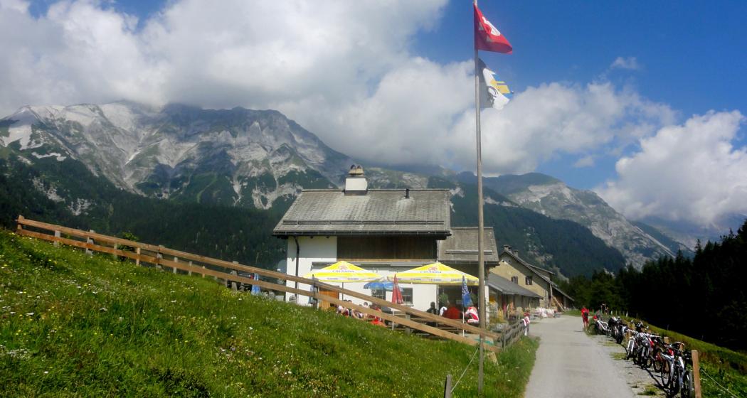
From the Ringelspitzhütte, the hike continues over the Kunkelspass to the Calanda Hut. A charming high-altitude hike high above the Graubünden Rhine Valley awaits you. Enjoy the panorama and the insight into the UNESCO World Heritage Site Sardona.
Technique 0/6
Fitness 0/6
Highest Point  2083 m
Lowest Point  1339 m
Best Season
Jan
Feb
Mär
Apr
Mai
Jun
Jul
Aug
Sep
Okt
Nov
Dez
Coordinates
46.8539, 9.53159

Details

Description

Guidelines

  • Duration: approx. 6 hours
  • Distance: 12.5km
  • Altitude difference: +850m/-800m

Responsible for this content Chur Tourism.
This content has been translated automatically.

City Felsberg

Felsberg

Felsberg mit Rhein
Felsberg mit Rhein

Show all 5 images

Felsberg
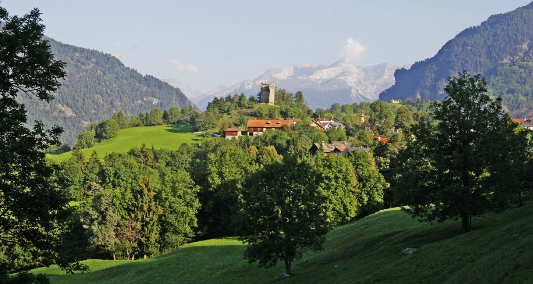
It is precisely because Felsberg is located away from the highly developed tourist rivers that you can look forward to special experiences at the foot of the Calanda. And you can tell this little village is special from the fact that it brought forth two Federal Councils - father and daughter, no less!

Description


Felsberg is barely touched by tourism, if at all. But it is a first-choice address for tours. From Chur, the route along Calanda mountain is a gateway from every cycling or inline-skating tour worth its name. There is an almost endless choice of routes for runners. Once you have made your way up to Alp Felsberg, you can call yourself a distinguished mountain biker. Wait for your heart rate to drop to a regular level and then lift your gaze across Chur and the Rhine and Schanfigg valleys. Test your endurance and continue the ascent up to Goldgruben.

But you can also take it easy. The hiking route along the Rhine joins with mountain hiking trails leading up through forests and meadows. The panorama trail across the military training area Rossboden is a great route for hikers and bikers alike. It is open on weekends for civilians en route to Haldenstein.

History

This area has been settles as early as the Neolithic era - proof for the fact that life has always been good here. The findings suggest that the area between the river Rhine and Calanda mountain was settled as far back as 2000 BCE. Perhaps even earlier than that, as some individual artefacts date back as far as the 7th century BCE.

Other than its neighbouring villages Domat/Ems and Chur, the community of Felsberg switched from Romansh to German fairly soon. The settlement that is mentioned in Romansh as "Villa Fagonio" in documents from the year 840 resurfaces in a document from 1290 under the German name "Veltsperch".

The village was first under rule of the Lords of Frauenberg who owned a castle in Felsberg. Unfortunately, nothing remains of it today. What was left of its walls was used in construction of bank reinforcements along the Rhine and a school.  From 1368, Felsberg became part of the Rhäzüns dominion. But other than most other parts of the dominion, Felsberg, along with Chur, adopted the Reformation in 1535 and became protestant. Its church is first mentioned in a document from 1305, but the current building was built in the early 16th century in late Gothic style.

Calanda

Calanda mountain has long kept the villagers of Felsberg on their toes with reoccurring rock falls that threatened to demolish the village. After a particularly devastating series of rock falls between 1832 and 1850, almost the entire village needed to be rebuilt some distance further east.

But Calanda mountain also brought treasures in the form of gold.  The local wines "Glockengiesser" and "Goldene Sonne" bear the memory of the 19th century in their names, when gold was extracted from mines that are visible to this day. You can have a look at their yield in the Rhaetian Museum in Chur, where the "Bündner Dublonen" are exhibited, Swiss Franc coins minted in 1813 from Felsberg gold. Due to a lack of sufficient yield, the mines eventually had to be closed around 1900.

Bell foundry

From 1817 to 1910, there was a bell foundry in Felsberg which produced more than 220 bells, among them the bell of the church St. Martin in Chur. There is also an organ manufactory in Felsberg that has been operating since 1898. Felsberg today has a population of some 2000, about 70% of which are employed elsewhere in places like Ems Chemie or in Chur.

Famous politicians

Felsberg is proud to have produced two important politicians, both stemming from the same family: Leon Schlumpf was born in 1925 and was member of the Federal Council from 1979 to 1987, and his daughter Eveline Widmer-Schlumpf, born 1956, who was herself a Federal Council from 2007 until 2015.

Contact

Responsible for this content Chur Tourism.

Kunkelspass round trip

Difficult
56 km
4:30 h
963 mhd
963 mhd
Aufstieg zum Kunkelspass
Kunkelspass - hier fährt kaum ein Biker vorbei

Show all 9 images

Kunkelspass
The Kunkels Pass bike tour is a real classic and well known among mountain bikers, cyclists and e-bikers. You completely ride around the impressive Calanda mountain on this tour.
Technique 1/6
Fitness 5/6
Highest Point  1357 m
Lowest Point  514 m
Best Season
Jan
Feb
Mär
Apr
Mai
Jun
Jul
Aug
Sep
Okt
Nov
Dez
Start
Chur, train station
Destination
Chur, train station
Coordinates
46.85416, 9.528797

Details

Description

From the Chur railway station, follow the national cycling route no. 2 (Rhine route) and cycle at the riverbank to Landquart. In Landquart, cross the Rhine river and later at Sarelli go left and follow the road up to Pfäfers and carry on to Vättis through a rugged basin with almost vertical mountain slopes.

The final ascent to the pass takes you away from the traffic through unspoilt, splendid countryside. Shortly past the Eggwald mountain restaurant, you leave the Canton of St. Gallen and enter Grisons again before reaching the pass summit.

When crossing from the Tamina Valley into the Rhine Valley, the great differences at either side of the water divide are amazing. The final descent to Tamins is a special treat, offering views of the confluence of the Vorder and Hinter Rhine. From Tamins take the national cycle route No. 2 (Rhine route) back to Chur (or return by rail from Reichenau station).

Responsible for this content Chur Tourism.

E-bike Kunkelspass (tour around the Calanda mountain range)

Medium
58.2 km
4:45 h
995 mhd
995 mhd
Churer Rheintal mit Calanda und Kunkelspass
Das eindrückliche Calanda-Massiv, von Brambrüesch aus gesehen (links der Ringelspitz)

Show all 10 images

Schlussaufstieg zum Kunkelspass
The circular tour of the Calanda massif over the Kunkelspass is a real classic. The historic pass route also offers an impressive scenic experience.
Technique 2/6
Fitness 3/6
Highest Point  1358 m
Lowest Point  515 m
Best Season
Jan
Feb
Mär
Apr
Mai
Jun
Jul
Aug
Sep
Okt
Nov
Dez
Start
Station Chur
Destination
Station Chur
Coordinates
46.853294, 9.529913

Details

Description

You have to do this tour once. For many cyclists it is one of the annual highlights. You experience the mighty Calanda massif from all sides. And who would have thought that it looks so rugged and jagged from the back. The route is extremely varied with the enjoyable start along the Rhine route. Via a side road with little traffic, you reach Pfäfers, where you cross the impressive Tamina bridge that spans the gorge. A long path through the Tamina valley follows via Valens, past the Mapragg reservoir and via Vättis finally to the Kunkelspass. The Überruf mountain inn stands at the top of the pass and offers the ideal opportunity for refreshments before the descent via the Forstrasse, at the beginning through tunnels hewn into the rock, leads down towards Tamins. The way back from there again follows the Rhine back to the Alpine City of Chur.

The Kunkelspass connects the Tamina valley (SG) with the municipality of Tamins (GR). It lies between the steep walls of the Calanda in the east and the mountain group around the Ringelspitz in the west. The narrow road and the tunnel on the Tamins side with the panoramic openings in the tunnel wall were built during the First World War. The Kunkelspass also forms the eastern entrance to the geological wonderland of the Tectonic Arena Sardona. At the pass near the Überruf mountain restaurant there is a seminar room with information about the UNESCO World Heritage Site. A telescope offers the opportunity to have a close look at the Ringelspitz and the Glarus thrust or the demolition niche of the Tamins mountain fall.

The Calanda massif consists of the four peaks Haldensteiner Calanda (at 2,805m the highest), Felsberger Calanda, Taminser Calanda and Berger Calanda (above Untervaz).

Directions

From Chur you follow the Rhine route 2 to Landquart. There you cross the Rhine and follow a little-used mountain road to Pfäfers, cross the Tamina gorge on the impressive Tamina bridge and then follow the mountain bike route 482 to the Mapragg dam. There you leave the route and ride on the road along the lake. After the lake, you follow route 482 again via Vättis to the Kunkelspass and down to Tamins, from where you finally return to the city of Chur on Rhine route 2.

Directions

Public Transport

Chur train station is easily accessible by SBB (Swiss Federal Railways), Rhaetian Railways, Postbus or Chur Bus.

Anreise Information

Motorway exit Chur Nord or Chur Süd and then drive to the city centre.

Parking

At Chur railway station two multi-storey car parks are available (Otto & Alex / SBB Park & Rail).

Responsible for this content Graubünden Ferien.

E-bike Domleschg castle tour

Geschlossen
Medium
61.3 km
4:25 h
618 mhd
618 mhd
Burg Castelberg
Schloss Ortenstein bei Tomils

Show all 8 images

Paspels mit Schloss Sins
An impressive circular tour through the Domleschg valley south of Chur, which is characterised by rolling hills, orchards and numerous castles.
Technique 2/6
Fitness 3/6
Highest Point  805 m
Lowest Point  564 m
Best Season
Jan
Feb
Mär
Apr
Mai
Jun
Jul
Aug
Sep
Okt
Nov
Dez
Start
Station Chur
Destination
Station Chur
Coordinates
46.853236, 9.529987

Details

Description

Along the right bank of the Rhine via Felsberg and Tamins, this tour first leads to Reichenau, where the confluence of the Vorderrhein and Hinterrhein is located, which can be seen impressively from the bridge. The tour continues picturesquely over the plateau of Bonaduz and Rhäzüns until you finally reach the Domleschg at Rothenbrunnen. Now follows a magnificent round tour through the southern-looking valley, which is characterized by rolling hills, orchards and numerous castles. A landscape that invites you to explore it on an e-bike. Again and again, the view sweeps over impressive castles, palaces and castle ruins - from Juvalt Castle near Rothenbrunnen to Hohen Rätien Castle near Sils, they characterize the Domleschg landscape. Lake Canova near Paspels invites you to take a refreshing dip in the water (bathing season from May to mid-October). The trail continues along the Polenweg with a view of the Rhäzünser Rheinauen, which are among the most intact floodplain landscapes in Switzerland and are of national importance. Behind the golf course of Domat/Ems with a view of the "Tumas" (the striking hills that originate from landslides and are under nature protection) then follows the last stretch back to the Alpine City of Chur. 

Directions

From Chur on the Rhine route 2 to Bonaduz. There ride across the plateau to Rhäzüns and along the road to Rothenbrunnen. Now follow the Graubünden Route 6 to Thusis and on to Sils. The return journey then follows through the hilly landscape along the castles and via Canova Lake back to Rothenbrunnen. From there on the Graubünden Route 6 back to Chur.

Directions

Public Transport

Chur train station is easily accessible by SBB (Swiss Federal Railways), Rhaetian Railways, Postbus or Chur Bus.

Anreise Information

Motorway exit Chur Nord or Chur Süd and then drive to the city centre.

Parking

At Chur railway station two multi-storey car parks are available (Otto & Alex / SBB Park & Rail).

Responsible for this content Graubünden Ferien.