discover.swiss ID
osm_1684212
discover.swiss Additional Type
City

Geological E-Bike tour: over the Kunkelspass around Calanda

Medium
60.5 km
4:30 h
1063 mhd
1064 mhd
Gemeinsam um den Calanda
Auf dem Weg zum Kunkelspass

Show all 5 images

Gemeinsam über den Kunkelspass
This round trip is a classic for E-Bikers. Especially those interested in geology will enjoy the Calanda Circuit.
Technique 3/6
Fitness 4/6
Highest Point  1358 m
Lowest Point  500 m
Best Season
Jan
Feb
Mär
Apr
Mai
Jun
Jul
Aug
Sep
Okt
Nov
Dez
Start
Bad Ragaz train station
Destination
Bad Ragaz train station
Coordinates
47.010059, 9.504616

Details

Description

The start of this geologically highly interesting round trip is in Bad Ragaz. After the village centre, you turn onto the old, picturesque road towards Valens, where you have to climb 300 metres in altitude for the first 4.5 kilometres. A panoramic stop on the Tamina Bridge, which opened in 2017, is a must. With a span of 260 metres, it is the largest arch bridge in Switzerland. From Pfäfers, follow the gently ascending main road into the Tamina Valley. The next stop is worth a stop at the Windegg viewpoint in front of Vadura. Here you can enjoy a wonderful view of the Glarus main thrust and the Wildseehörner. World Heritage information boards, viewing judges and cool loungers invite you to linger... but you probably want to go further.

At kilometre 16 you reach Vättis, where the exhibition 'BergeQuake!' shows the connection between earthquakes and mountain building in the Sardona tectonic arena... very impressive thanks to the live transmission of seismic recordings! Over the next few kilometres at the bottom of the bubbling Görbsbach, you can enjoy the view of the rugged limestone formations of the Haldensteiner (2,805 m) and Felsberger Calanda (2,697 m). The Eggwald mountain restaurant in Ober Kunkels (1148 m a.s.l.) invites you to stop for a bite to eat. A last short ascent, you have reached Graubünden soil and soon also the Kunkelspasshöhe (1,357 m a.s.l.). The garden terrace of the mountain inn Überuf is irresistible. The lovely pass plateau presents itself like an arena, surrounded by the Calanda (2805 m above sea level), the Crap Mats (2947 m above sea level) and the Ringelspitz (3247 m above sea level), the highest mountain in St.Gallen, located in the Tectonic Arena. Inside the inn, an educational information room is  dedicated to the UNESCO World Heritage Site of the Sardona Tectonic Arena.

The descent to Tamins (660 m a.s.l.) leads over a steep and bumpy natural road built during the First World War. The view from the tunnel blasted into the rock is spectacular. You can overlook the Domleschg and even see the Bernina massif in the distance. From Tamins, follow the national Veloland route no. 2 to Felsberg, where you continue along the right bank of the Rhine to Chur. Once again, you can educate yourself in geology: In the Chur Natural History Museum, a comprehensive geology exhibition focuses on the topic of Alpine formation. Then you can easily roll down the Rhine to Landquart and Bad Ragaz... or you can swing to the train station, look up again to the Calanda... and end the round on the railway.

Geheimtipp

Rent an e-bike at the e-bike station Bad Ragaz. This is located right next to the Tamina Therme, where you can treat yourself to a soothing bath after the tour.

Sicherheitshinweis

Take appropriate equipment with you to the tour and stay on the marked trails.

Ausrüstung

Normal bike equipment. Functional clothing is an advantage, as ascents and descents alternate.

Directions

Bad Ragaz – Pfäfers – Vättis – Kunkelspass – Tamins – Chur – Landquart – Bad Ragaz

Directions

Public Transport

By train to Bad Ragaz station

Anreise Information

Via motorway A13 exit Bad Ragaz

Parking

Parking directly at Bad Ragaz train station (chargeable)

Responsible for this content Graubünden Ferien.
This content has been translated automatically.

RheinWelten on the Rhine Route

Medium
438.5 km
30:00 h
1838 mhd
2913 mhd
RheinWelten
RheinWelten

Show all 8 images

RheinWelten führt dich zum Rheinfall
The "RheinWelten" e-bike route now connects Switzerland's existing cycling destination "Rhine Route 2" with regional, cultural and culinary highlights in 15 worlds of experience.
Technique 1/6
Fitness 3/6
Highest Point  2044 m
Lowest Point  258 m
Best Season
Jan
Feb
Mär
Apr
Mai
Jun
Jul
Aug
Sep
Okt
Nov
Dez
Start
Andermatt
Destination
Basel
Coordinates
46.634663, 8.596397

Details

Description

"RheinWelten" is a unique two-wheeler offer from the source of the Rhine to Basel for enjoyable explorers. 45 local tours in 15 adventure worlds can be discovered in Switzerland and Liechtenstein on an e-bike.  The tours combine visits to producers and farm shops, visits to museums or wineries, as well as local restaurants and overnight accommodations with the most beautiful cycling routes or hikes in the regions. The adventure worlds can be visited individually as a day trip or as a multi-day bike tour. 

Selected information on the new digital platform www.rheinwelten.com encourage people to discover new things. RheinWelten takes you through 12 tourist destinations in six cantons as well as the Principality of Liechtenstein. Experience unique cultural landscapes and the culinary diversity along the Rhine by e-bike.

Geheimtipp

Not the way is the goal, but the worlds of experience of the RheinWelten.

Ausrüstung

Roadworthy (e-)trekking bike, bicycle helmet, saddlebags or trekking backpack (approx. 35 litres) with rain cover, comfortable sports shoes, possibly cycling shoes, weather-adapted and durable clothing in the multi-layer principle, if necessary cycling jersey, change of clothes, cycling gloves, air pump, bicycle tools, sun and rain protection, provisions and drinking water, drinking bottle and suitable holder, first aid kit, pocket knife, mobile phone, if necessary mobile phone holder for the handlebar, headlamp and Reflectors, maps, travel documents, toiletry bags and towels, hand detergent and clothesline.

Directions

Rhine Route 2: Andermatt - Oberalppass - Disentis - Trun - Ilanz - Versam - Reichenau - Chur - Landquart - Jenins - Maienfeld - Sargans - Buchs - Oberriet - Altstätten - St.Margrethen - Fussach (D) - Gaissau (D) - Rohrschach - Arbon - Romanshorn - Kreuzlingen - Steckborn - Stein am Rhein - Gailingen (D) - Schaffhausen - Dachsen - Ellikon - Eglisau - Zurzach - Felsenau - Laufenburg - Stein - Rheinfelden - Pratteln - Muttenz - Basel

Directions

Public Transport

Arrival by train to Andermatt possible

Anreise Information

Motorway exit Göschnen direction Andermatt

Parking

Paid parking available

Responsible for this content Graubünden Ferien.
This content has been translated automatically.

D01 - T22 Via Francisca des Lukmaniers

Medium
476.1 km
125:15 h
6852 mhd
7191 mhd
T01 - T22 Via Francisca des Lukmaniers
T01 - T22 Via Francisca des Lukmaniers (oua_24516016_0e20ae1_profile)
The "Via Francisca des Lukmaniers" is also known as the "Street of the Emperors". It leads from Constance over the Lukmanier Pass to Pavia, where it meets the Via Francigena. Here is the official route in 15 Swiss stages, plus 7 stages in Italy.
Technique 1/6
Fitness 4/6
Highest Point  1978 m
Lowest Point  55 m
Best Season
Jan
Feb
Mär
Apr
Mai
Jun
Jul
Aug
Sep
Okt
Nov
Dez
Start
Konstanz ( Münster )
Destination
Pavia Church, San Pietro in Ciel d'oro. ( - Rome)
Coordinates
47.663249, 9.175472

Details

Description

www.viafrancisca.ch/wegbeschreibung/

Geheimtipp

For more explanations on the trail, visit us on www.viafrancisca.ch

Sicherheitshinweis

November - April possibly snow stages 10 and 11, Disentis-Lukmanierpass-Olivone. Use public transport.

Ausrüstung

Backpack with rain cover, well-worn footwear, durable clothing appropriate to the season, rain and sun protection, hiking stick or trekking poles, pilgrim's passport.

Directions

www.viafrancisca.ch/wegbeschreibung

Directions

Public Transport

Public transport to Konstanz and from Pavia. All stage towns can be reached by public transport.

Anreise Information

-

Parking

-

Responsible for this content Graubünden Ferien.
This content has been translated automatically.

Culinary tour "Bündner Rheintal" (E-Bike)

Simple
51.4 km
3:40 h
269 mhd
269 mhd
E-Bike Tour Bündner Rheintal
E-Bike Station Bad Ragaz

Show all 9 images

Fahrt durch die Reben
Combine a leisurely e-bike tour, from Bad Ragaz to the old town of Chur, with culinary stops at three different restaurants for starter, main course and dessert.
Technique 2/6
Fitness 2/6
Highest Point  655 m
Lowest Point  503 m
Best Season
Jan
Feb
Mär
Apr
Mai
Jun
Jul
Aug
Sep
Okt
Nov
Dez
Start
Bad Ragaz
Destination
Bad Ragaz
Coordinates
46.999248, 9.504763

Details

Description

Combine a leisurely e-bike tour, from Bad Ragaz through the "Graubünden Rhine Valley" region to the historic old town of Chur, with culinary stops in three different restaurants for starters, main courses and desserts.

Geheimtipp

After the tour, relax in the thermal water of the Tamina Therme and benefit from the relaxation bonus: pay 2 hours, relax for 4 hours.

Ausrüstung

Normal cycling equipment. Functional clothing is an advantage, as ascents and descents alternate

Directions

The tour starts at the e-bike station in Bad Ragaz. The first few metres run along the main road until you reach the historic town of Maienfeld. From there you cycle past vineyards to Jenins and Malans. After the idyllic village of Malans, you cross the Landquart River and continue to Igis, Zizers and Trimmis until you finally arrive in the oldest city in Switzerland - Chur. The way back to Bad Ragaz runs along the Rhine.

Directions

Public Transport

By train to Bad Ragaz, then by bus to Bad Ragaz, Post.

Anreise Information

Motorway exit Bad Ragaz, then on the main road to the village center of Bad Ragaz.

Parking

Public parking available at the multi-storey car park Zentrum, Tamina Therme or at the train station (for a fee).

Responsible for this content Graubünden Ferien.
This content has been translated automatically.

Trimmis - Malans

Medium
12.7 km
3:45 h
216 mhd
272 mhd
Das ehemalige Wasserschloss Marschlins liegt in der Ebene circa einen Kilometer nordöstlich von Igis.
Willkommen im Winzerdörfchen Malans

Show all 7 images

Breiter Kiesweg von Trimmis in Richtung Malans
The hike leads through forests and vineyards of the Five Villages and the Bündner Herrschaft.
Technique 2/6
Fitness 3/6
Highest Point  783 m
Lowest Point  536 m
Best Season
Jan
Feb
Mär
Apr
Mai
Jun
Jul
Aug
Sep
Okt
Nov
Dez
Start
Trimmis, Gargällis bus stop
Destination
Malans, Railway Station
Coordinates
46.902138, 9.562343

Details

Description

The hike through the vineyards and forests of the Five Villages into the Bündner Herrschaft begins at the northern end of the village at the "Gargällis" bus stop. Cross the access road to the village in a northerly direction and follow the sign for Molinära. After the Molinera, the path climbs slightly along the edge of the forest.

After another ascent to Dunkel Töbeli and over the Chessirüfi, you are already in the municipality of Landquart. At Birchholz there is a beautiful view of the village of Igis and the Rhine valley. It is worth stopping over the former moated castle of Marschlin. In slight ups and downs, the route continues to the Ganda, where it crosses under the Prättigauerstrasse.

After the passage at the tennis court, cross the river Landquart and walk along the right bank. After about 1 kilometre, leave the dam and head over the hay divider towards Malans station.


Geheimtipp

Refreshments in the Ganda at the tennis court (non-players are also welcome), broom pickling in the Heuteiler just before malans train station.

Sicherheitshinweis

Sections through the forest areas can be slippery in places after rainfall.

Ausrüstung

Normal hiking equipment. Depending on the weather, good footwear (hiking boots) is recommended, otherwise light trekking shoes are sufficient for the tour.

Directions

Trimmis - Molinära - Scheidrüfi - Dunkel Töbeli - Schlundrüfi - Birchholz - Marschlins - Ganda - Heuteiler - Malans

Directions

Public Transport

By train to Landquart or Chur, then by bus to the stop Trimmis Gargällis.

Anreise Information

Motorway exit Zizers, then on the main road to Trimmis. In the village, the path to the Älplibahn is signposted.

Parking

Public parking "Montalinstrass and Cholplatzweg" available (chargeable).

Responsible for this content Graubünden Ferien.
This content has been translated automatically.

Rhine-Route No. 2: Section 3 Chur - Buchs (SG)

Medium
47.5 km
3:15 h
107 mhd
248 mhd
Heidihaus Grand Tour
Maienfeld

Show all 4 images

Rheindamm
The Rhine route accompanies the Alpine river from its source in the mountains to the large Rhine ports of Basel. On varied paths, the journey leads through many landscapes that this powerful river has created over the course of time.
Technique 2/6
Fitness 4/6
Highest Point  630 m
Lowest Point  445 m
Best Season
Jan
Feb
Mär
Apr
Mai
Jun
Jul
Aug
Sep
Okt
Nov
Dez
Start
Chur, railway station
Destination
European box
Coordinates
46.854078, 9.528082

Details

Description

The Bündner Herrschaft, Graubunden's fertile garden and winery lies on a mound of slate detritus. Also the home of Heidi, Peter and Alpöhi (Heidi's grandfather).

Note(s)
Beware: in good weather, a strong wind blows up the Rhine Valley in the afternoon however down valley if the Föhn wind is blowing.

See also
Ostschweiz Tourismus
Fürstenlandstrasse 53
9000 St.Gallen
Tel:+41 (0)71 274 99 00
Fax: +41 (0)71 274 99 01
Email: info@ostschweiz.ch
Internet: www.ostschweiz.ch

Ausrüstung

Normal cycling equipment. Functional clothing is an advantage, as ascents and descents alternate

Directions

Chur - Igis Landquart - Jenins - Sargans - Buchs

Directions

Public Transport

By train to Chur.

Anreise Information

Take the motorway exit Chur Nord and follow the signs to the train station.

Parking

Public parking available at the train station in Chur (for a fee).

Responsible for this content Graubünden Ferien.
This content has been translated automatically.

T 06 Via Francisca: Maienfeld - Chur

Medium
24.9 km
6:45 h
479 mhd
373 mhd
T 06 Via Francisca: Maienfeld - Chur
Pilgerweg in Graubünden: Via Francisca: Maienfeld - Chur

Show all 3 images

T 06 Via Francisca: Maienfeld - Chur (oua_24511570_6eddf74_profile)
The "Via Francisca" is also known as the "Road of the Emperors". It leads from Constance over the Lukmanier to Pavia, where it meets the Via Francigena.
Technique /6
Fitness 4/6
Highest Point  753 m
Lowest Point  514 m
Best Season
Jan
Feb
Mär
Apr
Mai
Jun
Jul
Aug
Sep
Okt
Nov
Dez
Start
Maienfeld, railway station
Destination
Chur, Cathedral of the Assumption of the Virgin Mary
Coordinates
47.006933, 9.531564

Details

Description

After leaving Maienfeld, we walk through the vineyards of Jenins and Malans. After the village of Malans, we leave the "Graubünden dominion", as this wine-growing region is called.
Afterwards we cross the Landquart, which has left the Prättigau shortly before through a very narrow rock cut. In the upper part of this valley are the well-known ski resorts of Klosters and Davos.
We stay on the eastern side of the Rhine in the relatively wide valley to Trimmis, passing through other, smaller vine-growing areas. The Rhine Valley is now gradually changing direction to the west.
Leaving Trimmis, we then go up again to the valley flank, which brings us shade in the forest and also gives us the opportunity to look at the Rhine Valley from the heights. In doing so, we also bypass the extensive outskirts of Chur, which lie at the bottom of the valley. This takes us through a lot of nature directly to the cathedral of Chur, the capital of the canton of  Graubünden. 

Geheimtipp

The stages in this documentation are suggestions that each pilgrim can adapt to his wishes. however, the technical data always concern the assumption that these stages are completed in one day.

Sicherheitshinweis

.

Ausrüstung

Normal hiking/trekking equipment: backpack with rain cover, well-worn footwear, durable clothing appropriate to the season, rain and sun protection, hiking stick or trekking poles, pilgrim's passport.

Directions

Maienfeld - Eichholz - Erlenböden - Buochwald - Malans - River Landquart - Marschlins Castle - Igis - Zizers - Molinära - Trimmis - Bach Maschänser Rüfi - Fürstenwald - Waldhaus - Eulengut - Chur Cathedral

Directions

Public Transport

SBB

Anreise Information

A13 / E43

Responsible for this content Graubünden Ferien.
This content has been translated automatically.
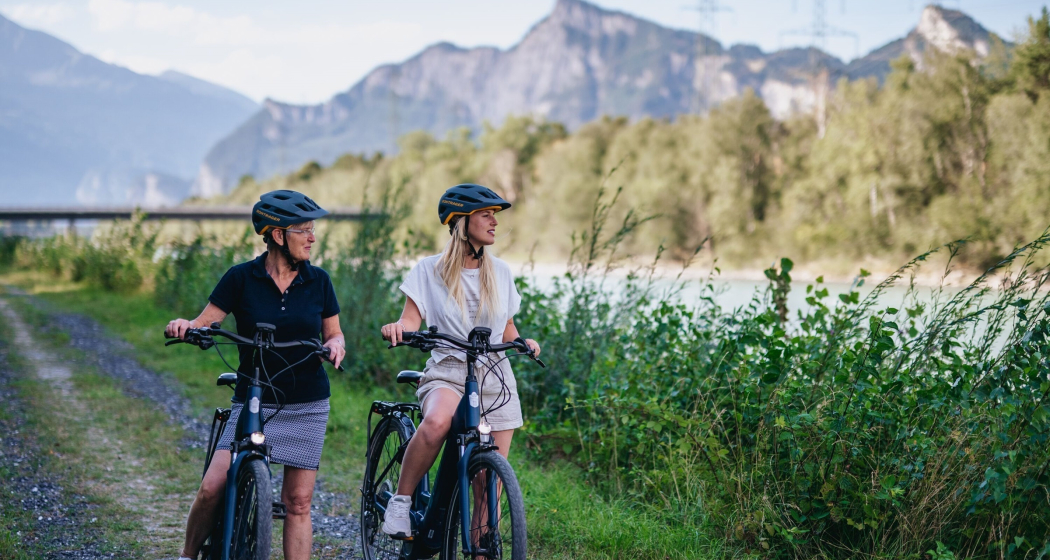
Mittagsplatte

Medium
30.2 km
3:55 h
943 mhd
941 mhd
Ziel der Tour: Mittagsplatte
Traverse auf dem Waldweg Richtung Unter Valzeina

Show all 7 images

Beschauliches Bergdorf Valzeina
Beautiful round tour leading to the striking viewpoint on the Mittagsplatte.
Technique 4/6
Fitness 4/6
Highest Point  1358 m
Lowest Point  516 m
Best Season
Jan
Feb
Mär
Apr
Mai
Jun
Jul
Aug
Sep
Okt
Nov
Dez
Start
Landquart, train station
Destination
Landquart, train station
Coordinates
46.967318, 9.554281

Details

Description

The ascent takes place on a mountain road with little traffic and later traverses on a forest path to Unter Valzeina. A short ascent on a mountain road and you reach the Mittagsplatte, which lies like an eagle's nest above the Graubünden Rhine Valley and offers a magnificent view. For the descent, first drive back a short distance before a relatively steep trail branches off to the left. This is especially challenging in the upper section and can only be ridden by technically experienced bikers (after 5 - 10 minutes of pushing, however, the trail becomes flatter and easier). Later it joins a forest road, which you follow to the village of Zizers. The return journey to Landquart takes place on the Rhine dam; the section between Zizers and Landquart runs on a good rideable trail.


Geheimtipp

Enjoy the breathtaking view on the lunch plate and take a short break.

Sicherheitshinweis

The beginning of the trail descent is only drivable for technically experienced bikers (please avoid driving with blocked brakes to prevent erosion). After 5 - 10 minutes of pushing, however, the trail becomes flatter and easier before it joins the forest road further down.

Ausrüstung

Normal hiking equipment, sturdy mountain boots.

Directions

Landquart - Malans - Ganda - Campingplatz Grüsch - Stein - Unter Valzeina - Valzeina - Mittagsplatte - Schlund - Zizers - Rheindamm - Landquart

Directions

Public Transport

By train to Landquart and from there the tour starts.

Anreise Information

Motorway exit Landquart, then on the main road in the direction of Landquart station.

Parking

Public parking available at Landquart train station (chargeable)

Responsible for this content Graubünden Ferien.
This content has been translated automatically.

Stams

Difficult
42.2 km
5:40 h
1349 mhd
1349 mhd
Valzeina
Stams

Show all 8 images

Picknickwiese hinter Stams
Beautiful mountain bike tour through a breathtaking landscape.
Technique 4/6
Fitness 5/6
Highest Point  1693 m
Lowest Point  518 m
Best Season
Jan
Feb
Mär
Apr
Mai
Jun
Jul
Aug
Sep
Okt
Nov
Dez
Start
Landquart, train station
Destination
Landquart, train station
Coordinates
46.967639, 9.554892

Details

Description

Varied bike tour with a beautiful descent through the magnificent and wild Valzeina Valley. The variant is particularly recommended here, because it offers further scenic as well as sporting highlights.


Sicherheitshinweis

Shooting range at Igis, evt. Bypass Marschlins Castle.

Ausrüstung

Normal bike equipment. Functional clothing is an advantage, as ascents and descents alternate

Directions

Landquart - Zizers - Trimmis - Says - Stams - Valzeina Valley - Landquart

Directions

Public Transport

By train to Landquart. The round trip starts from Landquart train station.

Anreise Information

Motorway exit Landquart, then follow the signalling on the main road towards Landquart station.

Parking

Public parking available at Landquart train station (chargeable)

Responsible for this content Graubünden Ferien.
This content has been translated automatically.

Wine Hiking Trail in Graubünden's Rhine Valley

Medium
27.1 km
7:00 h
423 mhd
479 mhd
Blick auf die Weinbauregion Bündner Herrschaft
Rebberge Bündner Herrschaft

Show all 6 images

Blick von oben auf die Weinregion
The wine hiking trail Bündner Rheintal connects the city of Chur with the wine villages in the Bündner Rheintal and Bündner Herrschaft.
Technique 1/6
Fitness 3/6
Highest Point  740 m
Lowest Point  525 m
Best Season
Jan
Feb
Mär
Apr
Mai
Jun
Jul
Aug
Sep
Okt
Nov
Dez
Start
Chur, Fläsch or along the route
Destination
Chur, Fläsch or along the route
Coordinates
46.853432, 9.529714

Details

Description

The scenic Rhine Valley near Chur, as well as Graubünden's north, known as Bündner Herrschaft, are regions that are predestined for wonderful walks and beautiful hiking tours. The wine villages and hiking trails are aligned like pearls along the Rhine River. Hike on a breezy autumn day when the "Föhn" blows across the Alps, when the wine harvest is drawing close and when one of the wine villages is preparing for a colorful fall festival - these are truly unforgettable experiences!

There are 3 circular tours through the vineyards along the way, Trimmis/Zizers (appr. 4 km), Malans/Jenins (appr. 10 km), Maienfeld/Fläsch (appr. 10 km). Together with the main trail from Chur to Fläsch (30 km), there are more than 40 km of signposted hiking tours available. A special map of the wine hiking trail is available at the tourist information at the railway station in Chur, as well as along the the way in the wine villages.

Due to its sunny location in the valley, the wine hiking trails are a good option almost all year round.

Responsible for this content Graubünden Ferien.