Viewpoint Tamins

Reichenau - confluence of the Rhine rivers

Reichenau - Zusammenfluss von Vorderrhein und Hinterrhein
The hamlet dominated by Reichenau Castle lies at the confluence of the Vorderrhein and Hinterrhein rivers and is thus virtually the birthplace of the Rhine.

Description

At the confluence of the Hinterrhein and the Vorderrhein, at the birthplace of the Alpine Rhine, is Reichenau. The place was already of great importance in the 14th century, when long-distance traffic over the Graubünden Alpine passes increased and two bridges and a customs house were built. Reichenau is a transport hub, where the routes of the north-south axis separate. Reichenau Castle stands in a spectacular location. Built in the 17th century by the Schauenstein episcopal minister family, it has a long history. The last king of France even lived here once. Today, the historical building belonging to the von Tscharner family is used as a winery.

Contact

Reichenau - confluence of the Rhine rivers

7015 Reichenau-Tamins

Responsible for this content Chur Tourism.

Brambrüesch-Känzeli-Schlittelweg

Simple
4 km
0:30 h
1 mhd
436 mhd
Schlittelweg Brambrüesch mit Aussicht
Beim Start

Show all 7 images

Unterwegs
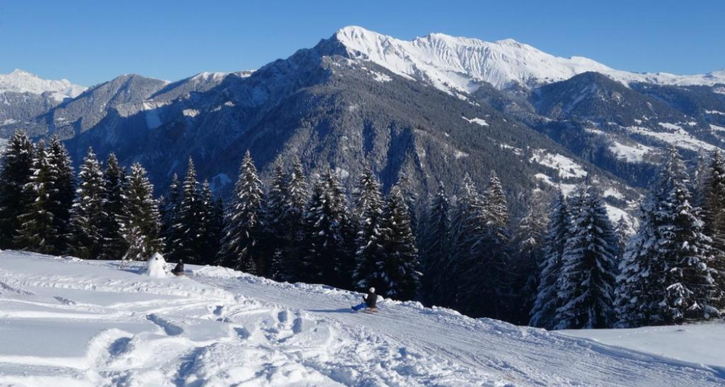
A few minutes to go up the mountain on the cable car to then go directly downhill at a racing speed: the ride from Chur’s home mountain, the Brambrüesch, to Känzeli leads through the forests and the Alps with a fantastic view of Schanfigg-Arosa.
Technique /6
Fitness /6
Highest Point  1593 m
Lowest Point  1179 m
Best Season
Jan
Feb
Mär
Apr
Mai
Jun
Jul
Aug
Sep
Okt
Nov
Dez
Start
Chur, Brambrüesch
Destination
Chur, Känzeli
Coordinates
46.827471520881, 9.5155411751768

Details

Description

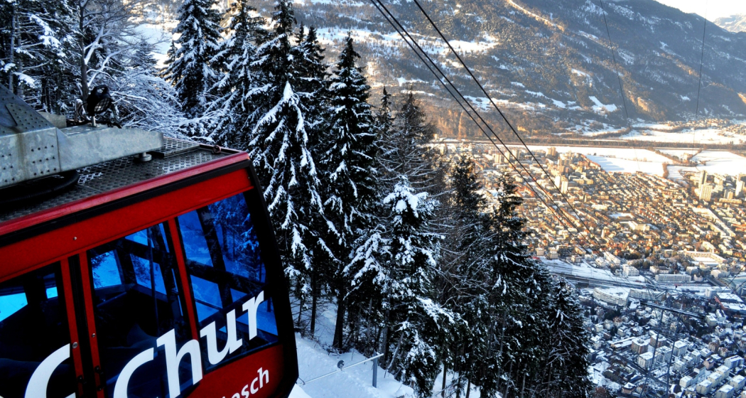
It is just one kilometre from the railway station of Chur to the valley station of the modern Brambrüeschbahn cable car. From the town limits, the cable car first stops at the Känzeli mid station and then the gondola continues to the home mountain of Chur – continuously along the ridge and with a view of the town and the Rhine valley of Chur.

The sledding adventure starts at an altitude of exactly 1000 metres above the canton capital, either directly at the mountain station or alternatively a little down from there near the ski lift. The slope features fast downhills, sweeping curves and some straight and relaxing passages, as well. On these particularly you are able to enjoy the panorama into the Grisons alpine world: The pristine Schanfigg valley with its Walser villages literally lie at your feet and on the right side of the valley, the Arosa Weisshorn is well visible.

Thanks to the even slope, the sled run is ideal for families and children. As the grand finale before the finish line at the Känzeli mid station, the view once more trails over the valley deep down to Chur below.

Directions

Public Transport

Take the train to Chur train station. From there, the city bus (line 1) takes 3 minutes to the valley station of the mountain railways (Stadthalle/Brambrüeschbahn stop).

Anreise Information

  •  Motorway exit Chur Süd

  • Drive into the city (Kasernenstrasse)

  • The valley station and car park are on the right-hand side in front of the town centre

Parking

Large car park on Weststrasse, right next to the Brambrüeschbahn and in front of the town hall. It is a 5-10 minute walk to the old town and the city centre. 

Suitable for passenger cars and taller vehicles

Responsible: Chur City Police, +41 81 254 53 00

Responsible for this content Brambrüesch.
This content has been translated automatically.

Brambrüesch - Känzeli pleasure hike

Simple
5.4 km
1:15 h
21 mhd
426 mhd
Brambrüesch - Känzeli Genusswanderung
Chur Bergbahnen (Hausberg Brambrüesch)

Show all 12 images

Brambrüesch - Känzeli Genusswanderung
This easy hiking tour is perfect for people who like leisurely walking with panoramic views.
Technique 1/6
Fitness 1/6
Highest Point  1605 m
Lowest Point  1179 m
Best Season
Jan
Feb
Mär
Apr
Mai
Jun
Jul
Aug
Sep
Okt
Nov
Dez
Start
Brambrüesch, top station of gondola
Destination
Känzeli, middle station of gondola
Coordinates
46.828999, 9.516007

Details

Description

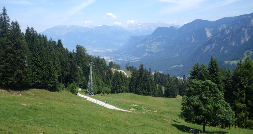
The ascent of this tour is very comfortable - just enter the gondola in Chur and  float to Brambrüesch. Up there on the high plateau, exactly 1'000 meters of height above the city of Chur, first you walk straight forward and you will pass three mountain restaurants: Battagliahütte, VIVA berg.baiz and Malixerhof. When you pass the Malixerhof, the descent into direction of Känzeli begins. Follow the wide forest road and enjoy the scenery and the panorama. Here and there you walk in the shade of the forest, then through some longer glades. In the middle section the panorama to the Schanfigg valley with the mountains of Hochwang, Arosa Weisshorn, Strelapass and Weissfluhgipel are particularly beautiful. Shortly before you arrive at the Känzeli the panorama to the city of Chur and the Rhine valley opens up. From the middle station Känzeli you can then float back into valley with the gondola.

Directions

Public Transport

Take the train to Chur station. From there, the city bus (line 1) takes 3 minutes to the valley station of the mountain railways (Stadthalle/Brambrüeschbahn stop).

Anreise Information

  • Motorway exit Chur Süd

  • Drive into the city (Kasernenstrasse)

  • The valley station and car park are on the right-hand side in front of the town centre

Parking

More about parking for guests of the Chur mountain railways.

Responsible for this content Brambrüesch.
This content has been translated automatically.

Brambrüesch - Känzeli

Simple
5.4 km
1:30 h
21 mhd
429 mhd
Brambrüesch - Känzeli

Show all 5 images

532 Brambrüesch-Feldis Trail (GR 1)
This easy hiking tour is perfect for people who like leisurely walking with panoramic views.
Technique 1/6
Fitness 1/6
Highest Point  1605 m
Lowest Point  1179 m
Best Season
Jan
Feb
Mär
Apr
Mai
Jun
Jul
Aug
Sep
Okt
Nov
Dez
Start
Brambrüesch, top station of gondola
Destination
Känzeli, middle station of gondola
Coordinates
46.828999, 9.516007

Details

Description

The ascent to Brambrüesch you conquer on this tour very comfortable, namely with the gondola from Chur. Arrived on the high plateau, exactly 1'000 meters above the city of Chur, you walk leisurely from the mountain station straight ahead past several mountain restaurants: Battagliahütte, VIVA berg.baiz and Malixerhof. So if you want to enjoy the view on a sun terrace, has a good selection. At the Malixerhof, it finally goes down towards the middle station Känzeli. The path runs parallel to the toboggan run, but is wide enough to accommodate sledgers and hikers. In contrast to the toboggan offer the winter hiking trail works even if there is little or no snow. Following the path gently downhill, you can enjoy the scenery and views. In between, you walk in the shadow of the woods, then come again longer open sections. In the middle section, the panorama into the Schanfigg Valley with Hochwang, Arosa Weisshorn, Strela Pass and Weissfluhgipfel is especially beautiful. Just before you arrive at the Känzeli, the view of the city of Chur and the Grisons Rhine Valley becomes clear. From the middle station Känzeli you can then comfortably hover with the gondola back to the valley.

Directions

Public Transport

Take the train to Chur station. From there, the city bus (line 1) takes 3 minutes to the valley station of the mountain railways (Stadthalle/Brambrüeschbahn stop).

Anreise Information

  • Motorway exit Chur Süd
  • Drive into the city (Kasernenstrasse)
  • The valley station and car park are on the right-hand side in front of the town centre

Parking

More about parking for guests of the Chur mountain railways.

Responsible for this content Brambrüesch.
This content has been translated automatically.

39 km
2:40 h
360 mhd
360 mhd
Churer Rheinroute 501, Pardislabrücke Haldenstein-Chur
Übergang Maschänser Rüfe

Show all 9 images

Trimmiser Mittelweg
Nothing but wine and water: on this circular route, you will discover the winegrowing villages between Chur and Landquart. The return journey takes place on the popular Rhine route and along the regional rivers Landquart and Plessur.
Technique /6
Fitness 2/6
Highest Point   m
Lowest Point   m
Best Season
Jan
Feb
Mär
Apr
Mai
Jun
Jul
Aug
Sep
Okt
Nov
Dez
Start
Chur
Destination
Chur
Coordinates
46.853287078552, 9.5299169101921

Details

Description

This varied loop tour begins in the middle of the Graubünden capital. But the busy city life is soon left far behind, because the route takes you on a tranquil neighbourhood road into nature. You cross the Fürstenwald, a popular local recreation area with views of the city and the Calanda. The historic Trimmiser Mittelweg then takes you through open pastures to the village of Trimmis. The route follows the "Bündner Rheintal Wine Trail" on several sections. Accordingly, it provides an insight into the local winegrowing culture. This has a long tradition as first mentions go back to the year 765. The Graubünden Rhine valley winegrowing region stretches from Bonaduz to Fläsch and covers around 420 hectares. Thanks to the mild climate and the foehn, the grapes thrive magnificently in the calcareous soils - especially the typical Blauburgunder variety.

Past the imposing, former moated castle of Marschlins, the route follows the Landquart river to the village of the same name. The Landquart has its source above Klosters, flows through the Prättigau valley and finally into the Rhine at Landquart. Here you return on the popular cycling route no. 2, the Rhine route. From Zizers, the path repeatedly follows the young Alpine Rhine. This has its source at the Oberalp pass as the Vorderrhein and at Rheinwald as the Hinterrhein. At Reichenau-Tamins, the two main arms join to form the Rhine. Switzerland’s largest river flows for a total of 1230 kilometres via Lake Constance through Germany, on to Holland, and into the North Sea.

At Haldenstein, you cross to the other river bank. At the level of the town of Chur, the cycle path crosses the Rhine again on the Pardisla bridge which was built especially for cyclists and pedestrians. Shortly afterwards you reach another regional river: the Plessur has its source in the mountainous area between Arosa and Lenzerheide, flows past Arosa through the Schanfigg valley and into the Rhine at Chur. The route follows the river, and over the arched bicycle and pedestrian bridge, built in 2020, you finally dive right into the centre of Chur with its picturesque, car-free old town. Before returning to the station, you can stop at one of the numerous restaurants with sun terraces. The tour comes to a leisurely end in the unique ambience of Switzerland's oldest city.

Directions

Public Transport

  • Start at railway station in Chur or Landquart

Anreise Information

  • On the motorway to Chur or Landuqart
  • Start at railway station in Chur or Landquart

Parking

  • Park & Ride at railway station in Chur or Landquart

Responsible for this content SwitzerlandMobility.

Simple
5 km
1:25 h
260 mhd
110 mhd
43.13 Tamins - Trin Digg, Jakobsweg Graubünden
43.13 Tamins - Trin Digg, Jakobsweg Graubünden (oua_9702365_d36a579_profile)
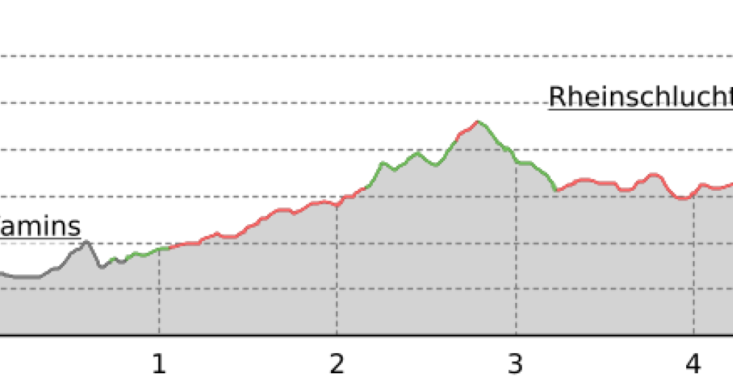
From the village square in Tamins, the path leads along the old country road to the hiking trail that winds its way up to the valley terrace. Impressive views of Bonaduz, Rhäzüns and the canyon of the Rhine Gorge open up here.
Technique /6
Fitness 2/6
Highest Point   m
Lowest Point   m
Best Season
Jan
Feb
Mär
Apr
Mai
Jun
Jul
Aug
Sep
Okt
Nov
Dez
Start
Tamins
Destination
Trin Digg
Coordinates
46.830057624899, 9.4070561008901

Details

Description

From the Tamins village square, along the old country road and hiking path up to the valley terrace. Extensive views over Bonaduz, Rhäzüns, Talenge through to Domleschg and the Rheinschlucht canyon. Trin-Digg and Trin-mulin form a part of Trin.

Responsible for this content SwitzerlandMobility.

Geschlossen
Medium
11 km
3:15 h
240 mhd
1000 mhd
Kathedrale St. Mariä Himmelfahrt
43.11 Tschiertschen - Chur, Jakobsweg Graubünden

Show all 3 images

43.11 Tschiertschen - Chur, Jakobsweg Graubünden (oua_9702261_38bc304_profile)
The descent leads along the northern slope of the Gürgaletsch through the wild Schanfigg valley and follows the Plessur River to the 5,000-year-old town of Chur. Light lark forests, the traditional Passugg Hotel Management School and tanned Walser houses catch the eye along the way.
Technique /6
Fitness 6/6
Highest Point   m
Lowest Point   m
Best Season
Jan
Feb
Mär
Apr
Mai
Jun
Jul
Aug
Sep
Okt
Nov
Dez
Start
Tschiertschen
Destination
Chur
Coordinates
46.817787465823, 9.606690444464

Details

Description

Along the mountain road through Praden; Bärenschlucht canyon crossing and on down to Grida-Passugg. Natural pathway from the resort to the Plessurbrücke (bridge). Chur cathedral with two significant Jakob exhibitions and Martinskirchplatz town centre.

Responsible for this content SwitzerlandMobility.

Simple
13 km
3:30 h
360 mhd
300 mhd
Kathedrale St. Mariä Himmelfahrt
43.12 Chur - Tamins, Jakobsweg Graubünden

Show all 3 images

43.12 Chur - Tamins, Jakobsweg Graubünden (oua_9702316_e2802cc_profile)
Shortly after the start there is a superb view of Chur. The route leads across a ravine, fields and meadows to Domat/Ems, which was built around seven hills. We continue along the Senda Sursilvana to Tamins.
Technique /6
Fitness 4/6
Highest Point   m
Lowest Point   m
Best Season
Jan
Feb
Mär
Apr
Mai
Jun
Jul
Aug
Sep
Okt
Nov
Dez
Start
Chur
Destination
Tamins
Coordinates
46.84741892032, 9.5319447087352

Details

Description

A view over Chur from the Rosenhügel. Through a cutting, over fields and meadows, to Domat/Ems - built around 7 hills. And along the Senda Sursilvana river to Tamins, where the Vorder and Hinterrhein meet. A visit to Rhäzüns and the famous Kirche Son Gieri with Jakobus display is well recommended.

Responsible for this content SwitzerlandMobility.

Simple
13 km
2:10 h
360 mhd
360 mhd
Rundtour Bonaduzer Wald 256
256 Bonaduzer Wald

Show all 17 images

256 Bonaduzer Wald
This tour opens up to magnificent views of the imposing Rhine Gorge. From Bonaduz the route passes through beautiful forest paths into the Rhine Gorge and back again.
Technique /6
Fitness 2/6
Highest Point   m
Lowest Point   m
Best Season
Jan
Feb
Mär
Apr
Mai
Jun
Jul
Aug
Sep
Okt
Nov
Dez
Start
Bonaduz
Destination
Bonaduz
Coordinates
46.810512104199, 9.3977179167695

Details

Description

The starting point of this mountain bike tour is the village of Bonaduz, which together with Rhäzüns forms an actual high plateau. Bonaduz is also the gateway to the Rhine Gorge Natural Monument.

After crossing the idyllic forest landscape near Bonaduz on well-maintained forest paths, an ascent follows on a road with little traffic, which leads to Sigl'Ault with great views. This is soon followed by a single trail that leads smoothly down to the panoramic road above the Rhine Gorge. The "Ruinaulta", as the gorge is called in Romansh, is one of the most magnificent and diverse landscapes in the Alps, which was formed by a landslide 10,000 years ago. You follow this road with a magnificent view down below, past the "Zault" viewing platform (photo stop recommended), before finally diving back into the forests and driving back to Bonaduz on extensive forest paths.

Geheimtipp

This route is usually drivable early in the year until late in autumn.

Sicherheitshinweis

Watch out for hikers. In the canton of Graubünden we share the paths.

Ausrüstung

Repair and first aid kit belong in the rucksack

Directions

This route is only signposted in one direction: Bonaduz – Sigl Ault – Zault.

Directions

Public Transport

Stop: Flims Dorf, mountain railways
By post bus from Chur or the public Flims Laax Falera Shuttle.

Timetable
www.sbb.ch

Anreise Information

By car on the A13 motorway from Zurich to Chur, exit 18 Reichenau

Parking

You will find parking spaces in Bonaduz at the railway station.

Responsible for this content Flims Laax Falera Management Ltd..
This content has been translated automatically.

Outdooractive Logo

This website uses technology and content from the Outdooractive platform.

Geschlossen
Simple
45 km
4:30 h
460 mhd
2900 mhd
615 Biketicket to ride blau

Show all 7 images

615 Biketicket to ride blau
For a leisurely ride and for families this round tour through idyllic countryside offers a lot of fun! With pleasant and gentle declines and slight ascents, this route is suitable even for bikes without extra suspension.
Technique /6
Fitness 4/6
Highest Point   m
Lowest Point   m
Best Season
Jan
Feb
Mär
Apr
Mai
Jun
Jul
Aug
Sep
Okt
Nov
Dez
Start
Lenzerheide
Destination
Lenzerheide
Coordinates
46.72715139073, 9.5578329519424

Details

Description

Taking the Tgantieni chairlift, the first step of the tour is comfortably begun. Above lies the alpine path, going to the Tgantieni Mountain Hotel and then further onto the Bergbeizli (small mountain pub) Spoina. The first part runs over well-prepared forest roads with occasional glimpses of Lenzerheide and Heid lake. The gentle descent passes the Valbella hostel and goes through Parpan village back to Churwalden.

A further nature trail brings you to Passugg, which is the source of a famous mineral water. The roaring creek Rabiosa, in Romansch «The Raging», cuts its way through the Passugg gorge. In 1863 this spring was rediscovered, which is known today throughout Switzerland as the mineral springs of Passugg. Next you drop down to Chur and take the gondola back up to Brambrüesch. From here descend again on a tarmac surface to Churwalden, where you take the chairlift Heidbüel.

Sicherheitshinweis

Attention:

- The Tgantieni and Scalottas chairlifts do not transport downhill bikes (double bridge fork)!

- Please note the respective operating times as well as the transport criteria before you start the tour. You can find more information here.

Ausrüstung

Protector jackets and full-face helmets are also prohibited. Normal helmets, knee and elbow protectors are permitted.

Directions

This route is only signposted in one direction: Lenzerheide-Tgantieni-Churwalden-Brambrüesch-Chruwalden-Alp Stätz-Lenzerheide

Directions

Public Transport

Travel by train to Chur, then transfer directly to the Postauto Graubünden buses to reach Lenzerheide within 30 minutes.

Anreise Information

Von Basel und Zürich - Chur-Süd (Ausfahrt Nr. 17) - Lenzerheide.

Von Milano - Lugano - San-Bernadino-Tunnel - Thusis - Chur (Ausfahrt Lenzerheide) - Lenzerheide.

Parking

Parking: Julier Parkplatz, Parkplatz Rothorn oder Parkplatz Tgantieni

Responsible for this content Graubünden Ferien.