Rhine Gorge Railway Hike: Reichenau - Trin Station

Geschlossen
Simple
4.9 km
1:15 h
17 mhd
13 mhd
Wandersteg am Rhein
Blick auf Reichenau-Tamins und das Churer Rheintal

Show all 7 images

Ausblick auf den Rhein und den Wanderweg
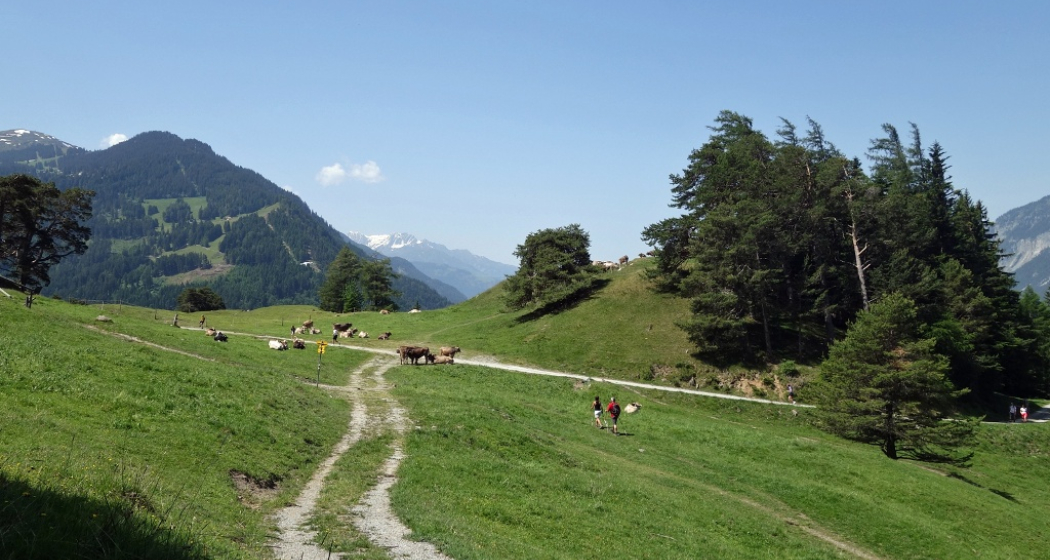
A rewarding, easy hike along the Rhine Gorge from Reichenau to Trin Station.
Technique /6
Fitness 1/6
Highest Point  608 m
Lowest Point  591 m
Best Season
Jan
Feb
Mär
Apr
Mai
Jun
Jul
Aug
Sep
Okt
Nov
Dez
Start
Reichenau railway station
Destination
Trin railway station
Coordinates
46.823889, 9.412874

Details

Description

The hike starts at Reichenau railway station, where you first cross the confluence of the Vorderrhein and Hinterrhein rivers and then walk along the Vorderrhein to Trin Station. After an initial stretch through the village, a beautiful hiking trail follows, always along the Rhine. In between there are always beautiful vantage points and good opportunities for breaks or barbecues. The hike is also ideal for families with small children, who can already hike on their own or are otherwise carried in a carry backpack (but not recommended for prams). At Trin Station you can optionally cross the Rhine on the suspension bridge.

Responsible for this content Chur Tourism.

Rhine Gorge Suspension Bridge - Wackenau Ruin (656.4)

Geschlossen
Medium
12.3 km
3:25 h
160 mhd
157 mhd
Wanderung zwischen Bahngleis und Rheinfluss
Ausblick auf den Rhein und den Wanderweg

Show all 7 images

Wandersteg am Rhein
Great round trip through the Rhine Gorge with crossing the bridge Punt Ruinaulta near Trin and the ruins and viewing platform Wackenau as another highlight.
Technique 2/6
Fitness 3/6
Highest Point  749 m
Lowest Point  591 m
Best Season
Jan
Feb
Mär
Apr
Mai
Jun
Jul
Aug
Sep
Okt
Nov
Dez
Start
Reichenau station
Destination
Reichenau station
Coordinates
46.824711, 9.408565

Details

Description

This circuit leads from Reichenau, the confluence of the Vorderrhein and Hinterrhein, along the Vorderrhein to Trin Station. Here you cross the Rhine over a 100 meter long suspension bridge (Punt Ruinaulta). A short, steep ascent follows. On the further way it is worth visiting the ruins of Wackenau and the viewing platform, which is slightly below the ruins and accessible from May to October. Through the Bonaduz forest you then return to Reichenau.

Responsible for this content Chur Tourism.
This content has been translated automatically.

Wine Hiking Trail in Graubünden's Rhine Valley

Medium
27.1 km
7:00 h
423 mhd
479 mhd
Blick auf die Weinbauregion Bündner Herrschaft
Rebberge Bündner Herrschaft

Show all 6 images

Blick von oben auf die Weinregion
The wine hiking trail Bündner Rheintal connects the city of Chur with the wine villages in the Bündner Rheintal and Bündner Herrschaft.
Technique 1/6
Fitness 3/6
Highest Point  740 m
Lowest Point  525 m
Best Season
Jan
Feb
Mär
Apr
Mai
Jun
Jul
Aug
Sep
Okt
Nov
Dez
Start
Chur, Fläsch or along the route
Destination
Chur, Fläsch or along the route
Coordinates
46.853432, 9.529714

Details

Description

The scenic Rhine Valley near Chur, as well as Graubünden's north, known as Bündner Herrschaft, are regions that are predestined for wonderful walks and beautiful hiking tours. The wine villages and hiking trails are aligned like pearls along the Rhine River. Hike on a breezy autumn day when the "Föhn" blows across the Alps, when the wine harvest is drawing close and when one of the wine villages is preparing for a colorful fall festival - these are truly unforgettable experiences!

There are 3 circular tours through the vineyards along the way, Trimmis/Zizers (appr. 4 km), Malans/Jenins (appr. 10 km), Maienfeld/Fläsch (appr. 10 km). Together with the main trail from Chur to Fläsch (30 km), there are more than 40 km of signposted hiking tours available. A special map of the wine hiking trail is available at the tourist information at the railway station in Chur, as well as along the the way in the wine villages.

Due to its sunny location in the valley, the wine hiking trails are a good option almost all year round.

Responsible for this content Graubünden Ferien.

Ice Rink Chur

Quader outdoor ice rink

Eisfeld Quader
Eisfeld Quader

Show all 10 images

Eisfeld Quader
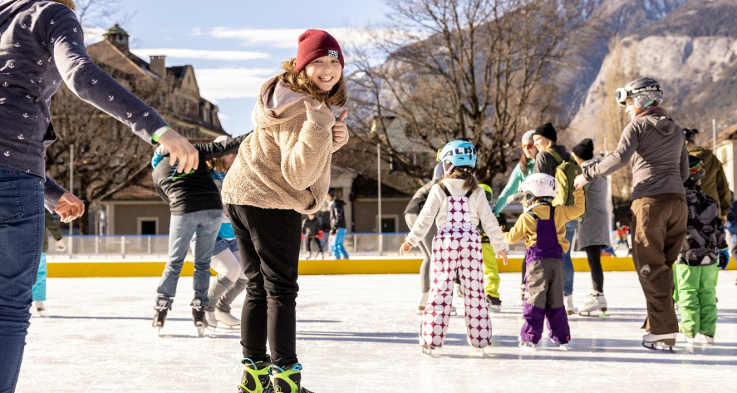
The romantic ice rink in the city center.

Description

The season on the Quader ice rink is over - we look forward to welcoming you again from 15 November 2025.

The Quader outdoor ice rink, with its romantic lighting and atmospheric music, is the winter meeting place in the heart of the city, just a two-minute walk from Chur railway station. Allow yourself to be enchanted by the fairy-tale ambience on the ice rink in front of the imposing Quader school building. A separate section is reserved for hockey enthusiasts, while the remaining area is open to people of all ages wishing to practise their ice-skating skills.

Khurer Gnusswaga
The "Khurer Gnusswaga" - Chur food stall - stands next to the Quader outdoor ice rink. The food stall offers homemade dishes for every appetite. A small heated tent next to the ice rink provides cosy warmth where you can enjoy your drink or meal. More information about the Khurer Gnusswaga 

Skating for wheelchair users
The Cerebral foundation has provided the city of Chur with a so-called "ice glider", a platform with its own blades that allows wheelchair users to access the ice. The gliders are designed to adapt to most common wheelchair models. The glider can be used free of charge. See flyer for images.

Prices

Please find ice sports prices here.

Ticket Shop
Buy your tickets online at the ticket shop www.sportanlagenchur.ch/ticketshop

  • buy your ticket online with or without ChurCard, adult or child
  • pay by credit/debit card or Twint
  • receive your ticket with QR code by e-mail
  • validate your QR code at the entry to the ice rink
  • let the ice fun begin!

The tickets are valid on the date of purchase. Purchased tickets cannot be cancelled.

Children unter 6 years are free when accompanied by a paying adult.

Equipment rental

  • Ice skates CHF 6.-
  • Beginners ice skates (2 blades) CHF 3.-
  • Sharpen ice skates CHF 14.- (within 1 to 3 days)
  • Skating aids per hour CHF 4.- 
  • Ice hockey stick CHF 3.-
  • Ice hockey helmet CHF 4.-
  • Soft puck CHF 4.- (sale only)

An ID-card has to be deposited for all rental items.

Please kindly place your group reservation via this format least 48 hrs in advance (reservations for Monday have to be done by Friday 12pm), thank you. You'll find the booking plan with the time slots already booked by groups here: Booking plan.

Opening hours

16.11.2024-02.03.2025* | Season start winter 2025/2026: 15.11.2025

  • Monday-Friday 11am-9pm
  • Saturday 10am-9pm
  • Sunday 10am-8pm, except 2. March 2025 open until 6pm
  • School classes possible from 10am on Tuesdays and Thursdays. Mandatory registration at least 48 hrs in advance (reservations for Monday have to be done by Friday 12pm). Please use this form. You'll find the booking plan with the time slots already booked by groups here: Booking plan.

*Season depending on weather

The Quader outdoor ice rink is generally always open, except in heavy rain or with lots of fresh snowfall. If the weather is uncertain, we will be happy to inform you on: +41 81 254 42 99

Holidays

  • Christmas Eve, 10am-4pm
  • Christmas Day closed
  • Boxing Day, 10am-8pm
  • New Years Eve, 10am-4pm
  • New Year, 10am-4pm
  • 2nd January, 10am-8pm

Special opening hours

  • Christmas holidays 23.12.2024-03.01.2025 opening at 10am on weekdays (food truck open daily from 11am)
  • Sports holidays 24.-28.02.2025 opening at 10am on weekdays (food truck opening daily from 11am)

Directions

Directions

Contact

Responsible for this content Chur Sports and Event Facilities.

Museum Chur

Graubünden Natural History Museum

Bündner Naturmuseum
Bündner Naturmuseum

Show all 7 images

Aussenansicht Bündner Naturmuseum
In the Graubünden Natural History Museum you will discover many interesting and exciting facts about the flora, fauna and geology of Canton Graubünden.

Description

The exhibitions at the Natural History Museum are dedicated to the rock formations, flora, and fauna of Graubünden Canton, with a focus on the biodiversity of the Alpine region. A rich programme of temporary exhibitions, events, and courses introduces visitors to fascinating natural phenomena. Collection work, research, and publications complete the museum services. Some of the most popular exhibits of the museum, like Switzerland's most notable gold discovery or the brown bear "JJ3" who roamed the Swiss mountains in 2007, are integrated into exhibitions on geology or mammal species in Graubünden. Temporary exhibitions complement the varied programme.

The museum takes great care to ensure that the complex ecological contexts are presented in a fashion that speaks to visitors of all ages. There is even a kids' play area for the smallest among them. 

Prices

Ingresses
Adults Fr. 6.-
Apprentices, students, AHV/IV Fr. 4.-
Children and young people (under 16 years) free of charge
School classes free of charge

Opening hours

  • Monday: closed
  • Tuesday - Sunday: 10am - 5pm

Contact

Graubünden Natural History Museum

Masanserstrasse 31, 7000 Chur

Responsible for this content Prättigau Marketing.

Outdooractive Logo

This website uses technology and content from the Outdooractive platform.

740 Känzeli Quelle Passugg

Geschlossen
Medium
12.8 km
4:45 h
225 mhd
664 mhd
Känzeli Quelle Passugg
740 Känzeli Quelle Passugg (oua_3945381_14a51ed_profile)
740 Känzeli Quelle Passugg
Technique 4/6
Fitness 4/6
Highest Point  1209 m
Lowest Point  659 m
Best Season
Jan
Feb
Mär
Apr
Mai
Jun
Jul
Aug
Sep
Okt
Nov
Dez
Start
Chur Train Station
Destination
Chur Train Station
Coordinates
46.853487, 9.52982

Details

Description

From the train station we follow the Arosa railway line to Meiersboden. In the forest, the path climbs to the Passugg spring. From there, go past the building on the right. After crossing the Rabiosa, the path climbs up to Malix. The trail continues through Malix past the Weisshütte until we finally reach the Känzeli mountain station. We enjoy the descent with a wonderful view of the city of Chur. From the valley station, the route leads through the Welschdörfli back to the train station. Please note the travel times of the Känzelibahn. In Malix, you can also use the post bus for the return journey.

Responsible for this content Brambrüesch.
This content has been translated automatically.

Cultural Hike: Maladers - Chur

Simple
4.7 km
1:30 h
41 mhd
428 mhd
St. Luzikapelle
Wanderweg nach Chur

Show all 4 images

Aussicht Chur

From the countryside of Schanfigg to the capital of Grisons - an adventurous hike for bon-vivants.

The easy hike is suitable for young and old. Especially kids love the diverse natural path through the forest. If you feel the hike is too short, you may also prolong it by detouring on the Mittenberg.

Technique 1/6
Fitness 2/6
Highest Point  1016 m
Lowest Point  623 m
Best Season
Jan
Feb
Mär
Apr
Mai
Jun
Jul
Aug
Sep
Okt
Nov
Dez
Start
Maladers
Destination
Chur
Coordinates
46.836774, 9.560407

Details

Description

The hike lasts almost 2 hours and leads from sunny Maladers through the forest towards the Mittenbergbelt and via the St.Luzi Chapel to the Haldenhüttli (small hut) from where you have a fantastic view over the city.

Comfortable arrival, enjoyable hike

The easy hike from Maladers (1000m) to Chur (600m) is suitable for everyone. With only a 15 minute bus ride from Chur we arrive at the starting point from where we start walking towards Oberdorf. After the first intersecting road we turn left and follow the directional sign to Chur. If you need supplies for the hike or a small souvenir, you might find it at Sina's farm shop. The path to Chur passes the cemetery and leads towards Mittenberg/Kleinwaldegg where it enters the forest. After a while we arrive at the little chapel St.Luzi. From there it is not far until we reach the Haldenhüttli (small hut) in the vineyards above Chur.

Author: Hansjürg Gredig, ZHAW Life Sciences and Facility Management

Geheimtipp

Sina's farm shop for a souvenir

Author: Hansjürg Gredig, ZHAW Life Sciences and Facility Management

Ausrüstung

Sturdy shoes, rain protection

Directions

The hike lasts almost 2 hours and leads from sunny Maladers through the forest towards the Mittenbergbelt and via the St.Luzi Chapel to the Haldenhüttli (small hut) from where you have a fantastic view over the city.

Comfortable arrival, enjoyable hike

The easy hike from Maladers (1000m) to Chur (600m) is suitable for everyone. With only a 15 minute bus ride from Chur we arrive at the starting point from where we start walking towards Oberdorf. After the first intersecting road we turn left and follow the directional sign to Chur. If you need supplies for the hike or a small souvenir, you might find it at Sina's farm shop. The path to Chur passes the cemetery and leads towards Mittenberg/Kleinwaldegg where it enters the forest. After a while we arrive at the little chapel St.Luzi. From there it is not far until we reach the Haldenhüttli (small hut) in the vineyards above Chur.

Author: Hansjürg Gredig, ZHAW Life Sciences and Facility Management

Directions

Public Transport

After a 15 minute bus ride from Chur we arrive at the starting point.

Responsible for this content Graubünden Ferien.
This content has been translated automatically.

Grottenstein - mystical castle ruins

Simple
2.9 km
1:15 h
268 mhd
268 mhd
Andreas Sommer (AnimaHelvetia) in der Burgruine Grottenstein
Grottenstein - mystische Burgruine (oua_31358472_73fd20d_profile)
Circular hike to the hidden castle ruins above the village of Haldenstein.
Technique 2/6
Fitness 2/6
Highest Point  835 m
Lowest Point  567 m
Best Season
Jan
Feb
Mär
Apr
Mai
Jun
Jul
Aug
Sep
Okt
Nov
Dez
Start
Bus stop Haldenstein Dorf
Destination
Bus stop Haldenstein Dorf
Coordinates
46.878763, 9.526762

Details

Description

As part of the 2nd Legends and Fairy Tale Days Chur, a guided hike to the Grottenstein castle ruins will take place on 25 November 2018 at 10 a.m. with exciting stories from the local world of legends, treasure-guarding cave fairies, enchanted toads and the golden skittles...  The stories are mysteriously interwoven with the direct experience of nature in the wintry mountain forest and in the enigmatic cave castle, where the campfire makes twitching shadows dance on the rock faces.

The ruins of Grottenstein Castle are located above Haldenstein. Little is known about its history, but a spring in the castle cave indicates a possible use as a refuge in times of need. Contrary to expectations, the name Grottenstein does not derive from the word Grotte in the sense of cave. Rather, the cave castle was originally called Chrottenstein, where Chrott means "toad". The reference to the toad now allows for completely different associations. The coinage as a toad place as well as local legends of a white maiden who guards sunken treasures and guards unborn souls inside the mountain, build mysterious bridges to mythology. In numerous legends, the toad and the white maiden appear as contrasting manifestations of the same entity, which often guards a hidden treasure of gold in caves and castle ruins. The auspicious treasure of gold is analogous to the basic maxim of alchemy, but is to be understood above all as a symbol for an inner treasure of the soul, an essential step in development or a realization. 

Ausrüstung

Sturdy footwear recommended.

Directions

The hike leads along the alpine road to the top and finally on a mountain hiking trail to the castle ruins. The descent takes place first on the same path as the ascent, but before the ruin Haldenstein you branch off to the right and follow the hiking trail back to the village.

Directions

Public Transport

Take the Chur city bus line 3 to the Haldenstein Dorf stop

Anreise Information

Motorway exit Chur Nord, turn off towards Haldenstein

Parking

Public parking in the village of Haldenstein.

Responsible for this content Chur Tourism.
This content has been translated automatically.

Rhine river trail in Chur

Simple
7.6 km
1:45 h
22 mhd
22 mhd
Uferweg am Alpenrhein
Unterhalb des Camp Au am Rhein-Ufer

Show all 10 images

Weg der Plessur entlang
A pleasant hiking tour from Chur to the nearby Rhine river.
Technique 1/6
Fitness 1/6
Highest Point  585 m
Lowest Point  554 m
Best Season
Jan
Feb
Mär
Apr
Mai
Jun
Jul
Aug
Sep
Okt
Nov
Dez
Start
Chur, train station
Coordinates
46.853525, 9.52957

Details

Description

The tour starts at the Chur train station, from where you soon follow the local stream called Plessur, which later on flows into the Rhine. Along the tree-covered riverside of the Rhine, you walk at the foot of the impressive Calanda mountain. On the way back to the city you will pass Switzerland's largest mural painting at the Mühleturm, then follow the Mühlebach stream and pass by the 1'200 m2 large sculpture park at the Forum Würth, where you can see artworks of famous artists like Jean Tinguely, Bernhard Luginbühl, Not Vital or Niki de Saint Phalle.

Directions

Public Transport

The tour starts directly at the train station of Chur.

Responsible for this content Chur Tourism.

Mittenberg - Maladers

Medium
10.5 km
3:15 h
440 mhd
520 mhd
Mittenberg - beliebtes Churer Ausflugsziel
Mittenberg mit Blick ins Churer Rheintal

Show all 6 images

Blick auf den Mittenberg und die Stadt Chur
Varied round hike from the city up to the panoramic Mittenberg and on nice trails to the sunny village of Maladers and back into Chur's Oldtown.
Technique 2/6
Fitness 3/6
Highest Point  1105 m
Lowest Point  585 m
Best Season
Jan
Feb
Mär
Apr
Mai
Jun
Jul
Aug
Sep
Okt
Nov
Dez
Start
Chur, Fürstenwald
Destination
Chur, Oldtown
Coordinates
46.870138, 9.544072

Details

Description

The Chur city bus no. 2 takes you the Fürstenwald above of the city. This is the starting point of this hiking tour. From there, follow the wide forest road steadily up to Mittenberg. On the way and on the Mittenberg you will find fountains with fresh spring water. Up at Mittenberg, you have a wonderful panorama view into the Chur Rhine valley and the surrounding mountains and is an ideal place for a picknick, as well.

Descent along the pastures to Maladers, Brandacker and below the Arosa street into the direction of the city again, past the Episcopal courtyard with the famous cathedral. There you will enter the wonderful and historic Old town of Chur again.

Responsible for this content Chur Tourism.