Chur Flow (707)

Simple
3.8 km
0:25 h
0 mhd
552 mhd
Chur Flow Trail im Alpenbikepark Chur

Show all 4 images

Chur Flow (707)
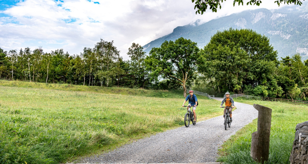
The Chur Flow is a freeride trail in the lower section of the Alpenbikepark Chur.
Technique 2/6
Fitness 2/6
Highest Point  1184 m
Lowest Point  632 m
Best Season
Jan
Feb
Mär
Apr
Mai
Jun
Jul
Aug
Sep
Okt
Nov
Dez
Start
Känzeli, middle station of gondola
Destination
Chur, valley station of the gondola
Coordinates
46.838581, 9.526002

Details

Description

The route is moderately steep and very varied. The main line works well for beginners. But also freeride cracks appreciate the route thanks to some crunchy side lines with jumps, drops, step-up & step-down and more elements.

Directions

Public Transport

Take the train to Chur station. From there, the city bus (line 1) takes 3 minutes to the valley station of the mountain railways (Stadthalle/Brambrüeschbahn stop).

Anreise Information

  • Motorway exit Chur Süd
  • Drive into the city (Kasernenstrasse)
  • The valley station and car park are on the right-hand side in front of the town centre

Parking

More about parking for guests of the Chur mountain railways.

Responsible for this content Brambrüesch.
This content has been translated automatically.

Chur panorama trail

Simple
8.1 km
2:15 h
168 mhd
168 mhd
Beim Fürstenwald mit Aussicht ins Rheintal
Fürstenwald mit Blick zum Calanda

Show all 9 images

Aussicht auf Stadt Chur mit Calanda
Out of the city into the beautiful recreational area of the Fürstenwald and with panoramic views back into the heart of the Alpine City.
Technique 1/6
Fitness 2/6
Highest Point  753 m
Lowest Point  584 m
Best Season
Jan
Feb
Mär
Apr
Mai
Jun
Jul
Aug
Sep
Okt
Nov
Dez
Start
Chur, train station
Destination
Chur, train station
Coordinates
46.853643, 9.529653

Details

Description

The sun-kissed panoramic trail starts in the city center and takes you in a circuit out of the city and into the beautiful forest of Chur. Along the edge of the forest you continue to the most beautiful viewpoint of the city (don't forget to bring your camera). Passing by the episcopal courtyard and the famous cathedral the tour finally leads into the historic old town of Chur and back to the starting point.

Responsible for this content Chur Tourism.

Mittenberg round trip

Simple
12.1 km
1:40 h
520 mhd
520 mhd
Prächtige Aussicht vom Mittenberg
Auf dem Mittenberg oberhalb Chur

Show all 4 images

Aussicht am Ziel ins Churer Rheintal
The Mittenberg is a classic among the mountain bike tours around Chur.
Technique 2/6
Fitness 2/6
Highest Point  111 m
Lowest Point  585 m
Best Season
Jan
Feb
Mär
Apr
Mai
Jun
Jul
Aug
Sep
Okt
Nov
Dez
Start
Chur, train station
Destination
Chur, train station
Coordinates
46.85311, 9.530094

Details

Description

Start at the Chur train station and cycle out of the city in eastern direction. Follow the Loestrasse, pass by the hospital and branch off right to the Fürstenwald, a nearby recreational area of Chur. The Fürstenwald (parking area) is a popular meeting place for outdoor athletes with several biking and running trails. Follow the forest road all the way up to the Mittenberg. In the upper part of the ascent you will find a fireplace with fresh spring water.

Up at Mittenberg, you have a wonderful panorama view into the Chur Rhine valley, on the opposite situated house mountain Brambrüesch and the mountains around Lenzerheide and the Bündner Oberland.

The descent route follows a smaller forest trail into direction of Vogelboden - Lürlibad - Lärchenboden - Chur city. Of course you can follow the easy route uf the uphill, as well. And if you prefer some technical trails, you will find some interesting options from the MIttenberg back to Chur.

Responsible for this content Chur Tourism.

Rhine Gorge hike: Bot Tschavier (656.7)

Simple
7.1 km
2:00 h
116 mhd
116 mhd
Aussicht auf den Vorderrhein Richtung Reichenau
Bonaduz

Show all 6 images

Rheinschlucht
A leisurely walk from Bonaduz around the Bot Tschavier hill, with beautiful views of the fascinating Rhine Gorge.
Technique /6
Fitness 2/6
Highest Point  749 m
Lowest Point  636 m
Best Season
Jan
Feb
Mär
Apr
Mai
Jun
Jul
Aug
Sep
Okt
Nov
Dez
Start
Bonaduz, train station
Destination
Bonaduz, train station
Coordinates
46.810478, 9.397953

Details

Description

A leisurely walk from Bonaduz, past the picturesque chapel of Sogn Mang and on a beautiful circular path with views of the Rhine Gorge and around the Bot Tschavier hill back to Bonaduz. A detour to the Wackenau ruin is possible. 

Responsible for this content Chur Tourism.

Chur - Trimmis - Zizers - Haldenstein - Chur

Simple
26.4 km
2:15 h
139 mhd
139 mhd
Trimmiser Mittelweg
Trimmiser Mittelweg

Show all 7 images

Churer Rheinroute 501, Pardislabrücke Haldenstein-Chur
Beautiful round tour from Chur, connecting the two new cycle paths Chur-Trimmis and Haldenstein-Chur with the Rhine route.
Technique 1/6
Fitness 2/6
Highest Point  655 m
Lowest Point  539 m
Best Season
Jan
Feb
Mär
Apr
Mai
Jun
Jul
Aug
Sep
Okt
Nov
Dez
Start
Chur railway station
Destination
Chur railway station
Coordinates
46.85354, 9.529757

Details

Description

The Chur-Trimmis cycle path over the Trimmiser Mittelweg was opened on 27 November 2019. It leads from the end of the Cadonaustrasse in Chur to the Blutmarchweg in the Fürstenwald and over a new bridge at the Maschänserrüfe and the Trimmiser Mittelweg to Trimmis. The Haldenstein-Chur cycle path was opened on 14 December 2018. It leads from Haldenstein along the Rhine to the Pardisla bridge, which was newly built and crosses the Rhine in the direction of Chur.

The two new cycle paths can be combined in a round tour from Chur via Zizers to a beautiful round tour. Provided there is no snow all the way down to the valley, this route can be used practically all year round and is also suitable in winter as a round route for cyclists, cross-country bikers, e-bikers or gravel bikers. Between Trimmis and Zizers, the tour leads through the vineyard landscape and on to Molinära Hof over a piece of unpaved ground (hiking trail). If you prefer to do the whole round on a paved surface, you can go in Trimmis directly down to the Deutsche Strasse and along it to Zizers - so the round is even suitable for racing cyclists (a short section through the Fürstenwald on the new cycle path Chur-Trimmis runs on a not asphalted but paved forest path).

Responsible for this content Chur Tourism.

CampAu Family tour

Simple
22.6 km
1:30 h
135 mhd
135 mhd
CampAu am Rhein-Ufer
Blick auf Reichenau-Tamins und das Churer Rheintal

Show all 4 images

Restaurant beim CampAu
Pleasant family cycling tour at the border of the Rhine river through the villages of the Chur Rhine valley.
Technique 1/6
Fitness 1/6
Highest Point  662 m
Lowest Point  557 m
Best Season
Jan
Feb
Mär
Apr
Mai
Jun
Jul
Aug
Sep
Okt
Nov
Dez
Start
Chur, Campsite Au
Destination
Chur, Campsite Au
Coordinates
46.861849, 9.507594

Details

Description

Start your tour at the campsite Obere Au. Cycle along the Rhine river to the village of Felsberg (in case the path is closed due to military exercises in this area, you can follow the official cycling route no. 2 and 6). The tour takes you then through the villages of Felsberg, Tamins, Reichenau, Domat/Ems and back to Felsberg and Chur. The campsite Obere Au has a playground for children and a restaurant, where you can have a meal and drinks.

Responsible for this content Chur Tourism.

Rhine Gorge hike: Turnerweg (659.10)

Simple
6.1 km
1:45 h
83 mhd
83 mhd
Bonaduz
Rheinauen Rhäzüns

Show all 4 images

Sogn Mang
The leisurely round tour begins in Bonaduz and leads on a hiking trail first to the Hinterrhein, along which you walk to the confluence with the Vorderrhein. A wide path then leads back to the village of Bonaduz.
Technique /6
Fitness 2/6
Highest Point  660 m
Lowest Point  587 m
Best Season
Jan
Feb
Mär
Apr
Mai
Jun
Jul
Aug
Sep
Okt
Nov
Dez
Coordinates
46.810442, 9.397925

Details

Description

From Bonaduz railway station, the route leads across wide fields and after a short descent directly to the bank of the Hinter Rhine. Now you can enjoy a wonderful walk along the banks of the Rhine with fascinating views of the Rhine floodplains, one of the last large natural river landscapes of the Rhine above Lake Constance. The trail leads towards Reichenau, where the Vorder Rhine joins the Hinter Rhine. The route finally leads back to the village of Bonaduz via a beautiful country lane.

Responsible for this content Chur Tourism.

Tschiertschen - Grida - Chur (10)

Geschlossen
9.8 km
3:15 h
109 mhd
846 mhd
Dominic Frei
Tschiertschen - Grida - Chur (10) (oua_49811119_1e457eb_profile)
Leisurely hike from Tschiertschen via Passugg, down to Chur - over hill and dale off the cantonal road
Technique 0/6
Fitness 0/6
Highest Point  1338 m
Lowest Point  600 m
Best Season
Jan
Feb
Mär
Apr
Mai
Jun
Jul
Aug
Sep
Okt
Nov
Dez
Coordinates
46.818241, 9.606541

Details

Description

From the village centre (1343 m above sea level) M) as on Route 9 via the car park at the entrance to the village, «Fraumatten» and «Usser Praden» (1160 m.a.s.l. M) to the fork in the path before the "Steinbachtobel", where the path to Runcalier–Churwalden branches off to the left. Here you turn right, cross the "Steinbachtobel" after a short descent and traverse the steep slope to the ravine on a narrow footpath. This passage requires careful walking, especially in wet weather! Via the mountain hut "Ricaldei" (1136 m.a.s.l. M) you soon reach the road (1146 m.a.s.l. M), over which you can now comfortably descend to "Grida". Here you leave the road to the left and hike via "Obergrida" (982 m above sea level). M) and «Untergrida» (942 m above sea level). M) along a footpath through meadows steeply to "Passugg Alte Post" (770 m above sea level). M). From here, it is recommended to take the path via "Meiersboden" and then hike above the "Rabiusa" to reach the outskirts of Chur.

Responsible for this content Info Tschiertschen-Praden.
This content has been translated automatically.

Rhine and Tuma heights around Domat/Ems

Medium
17.6 km
5:00 h
302 mhd
302 mhd
Domat/Ems und die markanten Tumas
Tumas und Kirchtürme von Domat/Ems

Show all 4 images

Domat/Ems mit Tumas und Blick ins Rheintal bis Chur
Interesting hiking tour around the so called «Tumas» (rubble cones) in Domat/Ems and the surrounding Rhine valley.
Technique 1/6
Fitness 3/6
Highest Point  790 m
Lowest Point  582 m
Best Season
Jan
Feb
Mär
Apr
Mai
Jun
Jul
Aug
Sep
Okt
Nov
Dez
Start
Domat/Ems, bus stop in the village
Destination
Domat/Ems, bus stop in the village
Coordinates
46.83376, 9.44758

Details

Description

The plain around Domat/Ems consists of different landslides: The Flimser Bergsturz, Kunkels and Calanda. The erosion has left over only the hard debris. This hills are called «Tumas» and build a protected nature reserve today.

The Chur city bus no.1 takes you from the main station to Domat/Ems (bus-stop «Domat/Ems Post»), the starting point. During this hiking tour you will explore different «Tumas», cross the Rhine river and visit the village of Tamins. On the way back to Domat/Ems, you cross the Rhine river another time, across a weir this time. At the same bus-station (Domat/Ems Post) you take the bus back to Chur.

Responsible for this content Chur Tourism.

Haldenstein castle ruins

Simple
8.1 km
2:35 h
329 mhd
324 mhd
Haldenstein mit Schloss und Ruine im Hintergrund
Schloss Haldenstein mit prächtigem Schlossgarten

Show all 8 images

Ruine Haldenstein
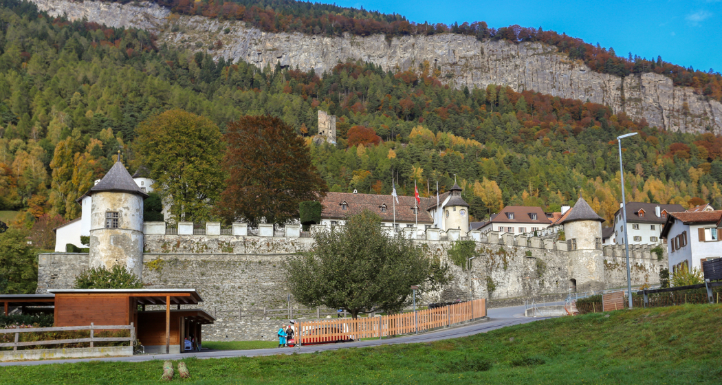
On this hiking tour you will discover the Castle of Haldenstein and the ruins above the village.
Technique 2/6
Fitness 2/6
Highest Point  834 m
Lowest Point  552 m
Best Season
Jan
Feb
Mär
Apr
Mai
Jun
Jul
Aug
Sep
Okt
Nov
Dez
Start
Chur, Obere Au
Destination
Haldenstein, village
Coordinates
46.858115, 9.506366

Details

Description

The Chur city bus, line no. 2 from Chur rail station with destination Obere Au, takes you to the starting point of this historic hike. At Obere Au, where the municipal sports facilities with swimming pool and barbecue area are also located, you cross a sparse copse, past the sand tennis courts to CampAu. The Plessur flows into the Rhine here. Now cross the Plessur bridge and continue along the right bank of the Rhine to the Pardisla bridge, where you finally cross the Rhine. Now follow the left bank of the Rhine until a path branches off to the left towards Haldenstein Dorfa. Continue through the upper village and follow the road up to Haldenstein Ruin.

Haldenstein Ruins

During the 12th century, the lords of Lichtenstein, mentioned in documents in 1180, split into two lines. The Lichtenstein branch retained the castle of the same name, while the Haldensteins, first mentioned in 1260, built their ancestral seat above the village of Haldenstein. After the extinction of the Lichtenstein branch, their property passed to the Haldensteins. The family died out at the end of the 14th century. From 1381 onwards, there were several changes of ownership. At the beginning of the 16th century, the castle was owned by Conradin von Marmals. After the death of Jakob von Marmals, the dominion and Haldenstein Castle passed to the French envoy, J.J. von Castion, the second husband of Jakob's widow. He had the new castle built in the village in 1542. Haldenstein Castle was still inhabited until 1695. In 1567 Gregor von Hohenbalken bought up the lordship, which developed into a sovereign dwarf state thanks to a letter of protection from the three confederations. Thereafter several changes of ownership. On 24 Dec. 1769, the south wall of the palace collapsed. After further earthquakes, in 1771 and 1787, other parts of the building collapsed. In 1803, the dominion lost its independence and was united with Graubünden.The Haldenstein ruins are difficult to access. The interior of the castle can be reached via the original access, fragments of which have been preserved (narrow rock band along the vertically sloping rock edge). Alternatively, there is a narrow window embrasure through which you can pull yourself through lying on your back.

>> Descend again briefly and then straight up until you reach the turnoff to the left to the Grottenstein ruins.

Grottenstein Ruins

As the name suggests, Grottenstein is a grotto castle. It exploits a natural cave under a prominent rocky outcrop. Water still seeps out of the rock in the cave today. This water deposit could have been the reason for the use of the rock overhang. The grotto castles are well protected from the weather by their location under the natural rock canopy. The need for renovation at Haldenstein's Grottenstein Castle is correspondingly low.

>> Return the same way and walk up a short distance along the road, then turn right and follow the path to the Lichtenstein ruins.

Lichtenstein Ruins

The ruins of Lichtenstein Castle are dominated by the main façade, which is visible from afar and set against the outermost edge of the abruptly sloping rock face. The preserved silhouette is reminiscent of a reclining cat with erect ears, hence the popular name "Katzenburg" (cat castle). The steady decay of the Lichtenstein ruin can be traced in historical illustrations. The stucco depiction from 1780 from the banqueting hall of the castle shows, in addition to the tower that still exists today in the northeast, an equally high part of the building in the southwest. The courtyard wall in the north-east still has intact battlements.

>> Return the same way and, after branching off into the lower road, shortly afterwards follow the hiking trail to the left in the direction of Haldenstein and on to Haldenstein Castle.

Haldenstein Castle

Haldenstein Castle is located on the southern edge of the village. It was built in the early 16th century on the site of an older stone house and was extended and sumptuously furnished by Johann Jacob von Castion in 1544-48; among other things, it has rich panelling that was sold abroad in the 1880s and can now be admired in Köpenick Castle near Berlin. In 1703, the castle came into the possession of the von Salis family. In 1731, Hubert von Salis added a storey, but it was largely destroyed by fire in 1732 and restored in 1732/33. From 1763-1771, the northern part of the castle housed an important seminary with up to 100 students at times, which was later moved to Marschlins Castle near Igis. In 1832, the castle passed to the Salis-Soglio family, who had it rebuilt around 1900. In 1922 it came into the possession of the Batänjer family and has been the property of a foundation since 1966. In 1986-1999 the castle was restored; today it serves as the headquarters of the Haldenstein municipal administration and the Graubünden Archaeological Service. Its rooms are made available by the foundation on a rental basis for a wide variety of events.

>> Way back to Chur

From the castle, follow the stairs down and along Bahnhofstrasse and over the Rhine bridge towards the Haldenstein-Rheinbrücke bus stop. Just above is the Haldenstein railway station. By train or bus you can get back to the city centre of Chur.

Responsible for this content Chur Tourism.