discover.swiss ID
osm_1684075
discover.swiss Additional Type
City

Dreibündenstein (Lady Patricia)

Difficult
40.8 km
5:00 h
1500 mhd
1500 mhd
Lady Patricia Trail
Lady Patricia Trail, gegenüber der Calanda

Show all 6 images

Kurz vor der Alp Juchs
This multifaceted and partly challenging day tour has all, what makes mountainbiking so special. The panorama trail with the crash site of "Lady Patricia" is also known as "Bomber Trail".
Technique 4/6
Fitness 5/6
Highest Point  2044 m
Lowest Point  559 m
Best Season
Jan
Feb
Mär
Apr
Mai
Jun
Jul
Aug
Sep
Okt
Nov
Dez
Start
Chur, train station
Destination
Chur, train station
Coordinates
46.817587, 9.50373

Details

Description

This challenging round tour starts at the northern side of the Chur railway station. Through the villages of Felsberg and Domat/Ems you reach the golf course in Domat/Ems. That's where the ascent starts. The mountain road is quite steep and it will take you some power to reach the mountain village of Feldis at 1'500 m. This is the perfect place to recharge your batteries in one of the restaurants.

From Feldis, continue on the level street in direction of Scheid. At point 1498 the next as-cent begins. Follow the paved mountain road up to the Alp di Plaun on 1953 m. At this point you can decide, whether you want to continue on the «Lady Patricia Trail» to Brambrüesch, or branch off and ascent to the Dreibündenstein. To continue on the here suggested route, follow the hiking trail to the ski hut Term Bel, turn right there and after 200 meters the trail branches off to the left side (follow the signal «Lady Patricia»). Before you reach the high route, the ascent continues and in the end you have to push your bike for appr. 10-15 minutes. When you have finally reached the height, a very panoramic and quite technical single track lies before you.

In the middle of the high route, you will find a memorial stone, where 1944 a US bomber has crashed into the mountain. The narrow single track traverses below of the Dreibündenstein. After that part, you come to enjoy the flow on the descent to Spundis. There, the trail branches off to the left and runs fluently at first, later more technical, to the Alp Juchs. From there, the trail continues demanding and challenging, before the last part of the descent will take you with a lot of flow back into the Alpine City of Chur.

Responsible for this content Brambrüesch.

CampAu Family tour

Simple
22.6 km
1:30 h
135 mhd
135 mhd
CampAu am Rhein-Ufer
Blick auf Reichenau-Tamins und das Churer Rheintal

Show all 4 images

Restaurant beim CampAu
Pleasant family cycling tour at the border of the Rhine river through the villages of the Chur Rhine valley.
Technique 1/6
Fitness 1/6
Highest Point  662 m
Lowest Point  557 m
Best Season
Jan
Feb
Mär
Apr
Mai
Jun
Jul
Aug
Sep
Okt
Nov
Dez
Start
Chur, Campsite Au
Destination
Chur, Campsite Au
Coordinates
46.861849, 9.507594

Details

Description

Start your tour at the campsite Obere Au. Cycle along the Rhine river to the village of Felsberg (in case the path is closed due to military exercises in this area, you can follow the official cycling route no. 2 and 6). The tour takes you then through the villages of Felsberg, Tamins, Reichenau, Domat/Ems and back to Felsberg and Chur. The campsite Obere Au has a playground for children and a restaurant, where you can have a meal and drinks.

Responsible for this content Chur Tourism.

Domleschger Loop

Simple
56.2 km
3:00 h
386 mhd
386 mhd
Schloss Ortenstein
Churer Rheintal

Show all 5 images

Schloss Rhäzüns
Domleschger Loop
Technique /6
Fitness 2/6
Highest Point  777 m
Lowest Point  561 m
Best Season
Jan
Feb
Mär
Apr
Mai
Jun
Jul
Aug
Sep
Okt
Nov
Dez
Start
Chur, Obere Au
Destination
Chur, Obere Au
Coordinates
46.854236, 9.50527

Details

Description

The perfect after-work tour: This mostly flat round trip leads from Chur via the Chur Rhine Valley through the picturesque Domleschg.  Most of the journey leads through gentle hilly landscapes, past wonderful orchards and imposing castles and palaces.

Responsible for this content Chur Tourism.
This content has been translated automatically.

Calanda (hut) round tour

Difficult
23.1 km
7:00 h
1530 mhd
1530 mhd
Tiefblick auf die Stadt Chur
Weit oberhalb der Alpenstadt Chur

Show all 8 images

Blick vom Rossboden auf den Felsberger Calanda
Beautiful round tour from Haldenstein to the Calanda hut und back to Chur. Recommended with overnight in the hut and additional ascent to the Calanda peak.
Technique 3/6
Fitness 5/6
Highest Point  2083 m
Lowest Point  562 m
Best Season
Jan
Feb
Mär
Apr
Mai
Jun
Jul
Aug
Sep
Okt
Nov
Dez
Start
Haldenstein, bus stop in the village
Destination
Chur, bus stop Obere Au
Coordinates
46.878781, 9.526922

Details

Description

The Chur city bus no. 3 takes you to the starting point in the village of Haldenstein. Follow the well-marked path to the Calanda mountain hut. On the way up, you will pass by the alps of Arella and Nesselböden. Continuously walking up-wards you will reach the alp Altsäss. From there it's just 100 meters in height to the Calanda hut (2073 m.).

The optional, but well worth ascent to the Calanda peak (Haldensteiner Calanda, 2'805 m) means an additional 730 meters of height difference and appr. 2 hours walking time. Recommended with overnight in the Calanda hut and ascent at sunrise. On the Calanda peak you will enjoy fantastic panorama views. If you just walk as far as the Calanda hut, you can enjoy some food and drinks there before the way back.

For the descent walk southwards along to the Felsberger Älpli. The descent to Felsberg is leisurely at first, but continuously getting steeper while descending. Leave the village of Felsberg on the right hand side and follow the Rhine river for a short distance. After crossing the Rhine river walk through the Rossboden and at the P & R parking area Obere Au you can take the bus back into the city.

Responsible for this content Chur Tourism.

Felsberger Älpli - Kunkelspass

Difficult
26 km
7:30 h
1580 mhd
1580 mhd
Blick von der gegenüberliegenden Seite auf das Calanda Massiv
Berggasthaus Überruf am Kunkelspass

Show all 5 images

Blick zurück auf den legendären Kunkelspass
Impressive tour into the mountain world of Chur, at the mountainside of the mighty Calanda massif.
Technique 3/6
Fitness 5/6
Highest Point  2080 m
Lowest Point  565 m
Best Season
Jan
Feb
Mär
Apr
Mai
Jun
Jul
Aug
Sep
Okt
Nov
Dez
Start
Felsberg
Destination
Felsberg
Coordinates
46.84458, 9.47677

Details

Description

To Felsberg you can get easily from Chur with the city bus (line 1) or the Rhaetian Railway. After a steep ascnet you will be rewarded by a gorgeous scenery and unique views on the mountain and into the valley. If you are lucky, you can even spot some wild animals (chamois, alpine ibex) in the surroundings of this tour. At the Kunkelspass is the ideal point for a break at the restaurant Überruf. The way back into the valley along Foppaloch, Benis Boden and along the Senda Sursilvana is worthwile, as well.

Responsible for this content Chur Tourism.

Panoramic trail Haldenstein - Felsberg

Medium
11 km
3:05 h
263 mhd
262 mhd
Blick auf die Stadt Chur vom Zielhang aus
Aussicht oberhalb von Haldenstein auf die Stadt Chur

Show all 6 images

Aussicht vom Panoramaweg in Richtung Churer Rheintal
This panoramic trail leads along the Calanda massif and offers a beautiful panoramic view over Chur and the surrounding mountains. Only on weekends continuously walkable.
Technique /6
Fitness 3/6
Highest Point  814 m
Lowest Point  554 m
Best Season
Jan
Feb
Mär
Apr
Mai
Jun
Jul
Aug
Sep
Okt
Nov
Dez
Start
Bus stop Obere Au P+R, Chur
Destination
Bus stop Obere Au P+R, Chur
Coordinates
46.854219, 9.505518

Details

Description

This leisurely circular hike leads along wide natural paths along the Calanda massif. The hike starts from the Obere Au and leads along the Rhine to Haldenstein, where the path leads up to the Panorama Trail. Optionally, the tour can also be started from Haldenstein. 

 
Closure of the finish slope Arabüehl: Please note that the section of the Panorama Trail, which runs through the Waffenplatz finish slope (Calanda finish slope), is only open from Friday, 5 p.m. to Monday, 7 a.m. General winter closure from mid-November to mid-April. More information at https://www.vtg.admin.ch/de/die-schweizer-armee/waffen-schiessplaetze/waffenplatz-chur.html 

Geheimtipp

Optionally, the tour can also be started from Haldenstein. Haldenstein is easily accessible by bus from Chur. Likewise, the tour can already end in Felsberg. From Felsberg you can take the bus or the Rhaetian Railway back to Chur.

Sicherheitshinweis

Closure of the finish slope

Arabüehl: The path through the finish slope is only open to a limited extent. Therefore, it is advisable to check the homepage of the Waffenplatz Chur to see if it is open or not. For more information, see https://www.vtg.admin.ch/de/die-schweizer-armee/waffen-schiessplaetze/waffenplatz-chur.html

Directions

This hike starts at the bus stop Obere Au P+R, where there are also parking facilities. From here the path leads to the Rhine. From here, the path runs along the banks of the Rhine to the Pardisla Bridge. This bridge is crossed and the path continues to Oldiswald, where the path turns left. Follow this path to the village entrance Haldenstein, where the höhenweg begins. 

Here the path winds gently up the hill. Continue over pastures and through forest, along the Calanda massif. On the way, there are always wonderful viewpoints of Chur and the surrounding mountains. Various benches invite you to take a break and enjoy the panorama. 

Soon you have reached the military target slope Arabüehl above Chur. As soon as you have traversed it, you will continue through a tunnel on a paved road. This leads down, in the direction of Felsberg. At the bottom of unter Neugüter Strasse, the path leads to the left, in the direction of the banks of the Rhine. Along the Rhine it goes back to the starting point in the Upper Au. Alternatively, you can turn right on Unter Neugüter Strasse and walk to Felsberg and end the tour there.

Directions

Public Transport

By bus from Chur to Obere Au, Chur Bus line 2 runs regularly from Chur train station to Obere Au Station: Chur,

Obere Au
P+R

By bus from Chur to Haldenstein(abbreviated variant)
Bus line 3 runs regularly from Chur
train station to Haldenstein
Station: Haldenstein, Usserdorfstrasse

By bus/Rhaetian Railway from Felsberg to Chur

Bus line 1 and various Rhaetian Railway
trains run regularly from Felsberg to Chur. 
Bus stops: Felsberg, Bahnhof / Felsberg, Calanda
Stop Rhaetian Railway: Felsberg station

Parking

Parking in the parking lot Obere Au P+R

Responsible for this content Chur Tourism.
This content has been translated automatically.

rhiienergie Trail Felsberg

Medium
8.9 km
2:25 h
550 mhd
550 mhd
rhiienergie Trail Felsberg
rhiienergie Trail Felsberg (oua_25240669_e6d0ed3_profile)
The Felsberg Trail (red signage) is almost 9 km long with a height difference of 440 meters.
Technique 2/6
Fitness 4/6
Highest Point  1008 m
Lowest Point  588 m
Best Season
Jan
Feb
Mär
Apr
Mai
Jun
Jul
Aug
Sep
Okt
Nov
Dez
Start
Felsberg
Destination
Felsberg
Coordinates
46.843184, 9.46418

Details

Description

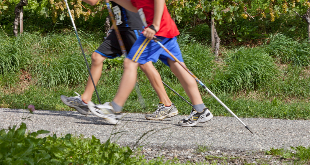
In the communes of Bonaduz, Domat / Ems, Felsberg, Rhäzüns and Tamins, rhiienergie created five interconnected Nordic Walking routes (also suitable for jogging / running). Each route runs for about 10 kilometers on existing paths and roads across meadows and through forests. A corresponding signage shows on the one hand the way direction and on the other the respective distance covered.

Responsible for this content Chur Tourism.
This content has been translated automatically.

Chur – Ilanz

Medium
49.9 km
4:50 h
1249 mhd
1006 mhd
Rheinschlucht
Gravel&Road Graubünden

Show all 6 images

Gravel&Road Graubünden
Between the Alpine town of Chur and Ilanz there are 35 kilometres and 500 metres of altitude difference – if you choose the direct route. On this gravel bike tour you will diligently collect additional kilos and altitude meters thanks to a worthwhile additional loop into the Safiental.
Technique 3/6
Fitness 3/6
Highest Point  1581 m
Lowest Point  559 m
Best Season
Jan
Feb
Mär
Apr
Mai
Jun
Jul
Aug
Sep
Okt
Nov
Dez
Start
Chur
Destination
Anonymous
Coordinates
46.861349, 9.50708

Details

Description

You start in Chur (593 m above sea level) and ride along the Rhine on the cycle path to Reichenau, where the Anterior and Rear Rhines meet. On side roads, follow cycle path number 3 to Bonaduz (662 m above sea level). Here you can access the spectacular road through the Ruinaulta. The Rhine Gorge, with its 300-metre-high rock faces and rock formations, is also called the "Swiss Grand Canyon". Take a short break to enjoy one of the most diverse landscapes in the Alps. Over the bridge at the end of the first short descent, you will enter a short climb with magnificent hairpin bends that leads to Versam (909 m above sea level). Right at the entrance to the village, turn off in the direction of Safiental and follow the mountain bike route no. 157 "Calörtsch". Via Arezen you reach the mountain pastures near Calörtsch (1401 m above sea level) on dirt roads through forests and meadows. Here you can enjoy a particularly impressive panoramic view of the Flimserstein. Following the MTB route, a short forest path through the Calörtscher Forest (1580 m above sea level) will take you back to a road that will take you to the idyllic village of Brno (1287 m above sea level). The fast descent from Brno will take you back to cycle route 3, which you will follow in the direction of Valendas (809 m above sea level). Valendas delights not only with countless well-preserved manor houses, but also with the largest wooden fountain in Europe. From here, follow the cycle route to Ilanz (699 m above sea level), the first town on the Rhine. From Ilanz you can take the Rhaetian Railway back to the starting point in Chur.

Responsible for this content Graubünden Ferien.
This content has been translated automatically.

E-bike Rhine Gorge circuit

Medium
65.2 km
5:20 h
1154 mhd
1133 mhd
Einzigartige Naturkulisse: Die Rheinschlucht
Aussichtspunkt Zault zwischen Bonaduz und Versam

Show all 9 images

Rheinschlucht
The circuit tour of the Rhine Gorge is an extended but rewarding day trip with numerous viewpoints along the Rhine Gorge, the beautiful Cresta Lake and the confluence of the Rhine.
Technique 2/6
Fitness 4/6
Highest Point  1169 m
Lowest Point  564 m
Best Season
Jan
Feb
Mär
Apr
Mai
Jun
Jul
Aug
Sep
Okt
Nov
Dez
Start
Station Chur
Destination
Station Chur
Coordinates
46.853213, 9.530019

Details

Description

The circular tour around the Rhine Gorge from Chur includes numerous highlights and is extremely varied. At the beginning of the route, you cross the Rhine twice at Reichenau, where the Vorderrhein and Hinterrhein rivers meet. After Bonaduz, the spectacular road follows above the Rhine Gorge via Versam and Valendas. The Zault and Spitg viewing platforms reveal magnificent views of the natural wonder of the Rhine Gorge. On the way back, after the climb to Laax, there is a beautiful section through the Flimserwald forest and to the Conn lookout tower, from where a sensational panorama of the Rhine Gorge opens up from high above. The next highlight is Lake Cresta, before the return trip via Trin, Tamins and Felsberg back to the Alpine City of Chur.  

Directions

From Chur on the Graubünden Route 6 to Domat/Ems. Along the edge of the golf course in the direction of Reichenau train station. There follow the Rhine Route 2 via Bonaduz along the Rhine Gorge to Valendas. In the village, turn right and descend to Valendas train station, where the Rhine is crossed on the bridge. From there follows an ascent through the forest to Laax. However, the route branches off again immediately and leads along bikeroute 90 past Lake Cauma in the direction of Trin. Before Conn turn off and ride to the viewpoint and restaurant Conn. Then back on the bike route Graubünden 90 and via Crestasee to Trin Mulin. There cross the road to Trin village and go through it. Before entering the main road to Tamins, cross under it and shortly afterwards continue on the Graubünden 90 bike route to the village of Tamins. In the village center change to the Rhine Route 2 and follow it back to Chur.

Directions

Public Transport

Chur train station is easily accessible by SBB (Swiss Federal Railways), Rhaetian Railways, Postbus or Chur Bus.

Anreise Information

Motorway exit Chur Nord or Chur Süd and then drive to the city centre.

Parking

At Chur railway station two multi-storey car parks are available (Otto & Alex / SBB Park & Rail).

Responsible for this content Graubünden Ferien.

Tschengels

Difficult
14.3 km
2:00 h
529 mhd
534 mhd
Tschengels
Aufstieg durch die Weinreben oberhalb Felsberg

Show all 8 images

Einstieg in den Trail
Round tour from Felsberg with technically demanding descent via Benis Boden.
Technique 4/6
Fitness 2/6
Highest Point  1093 m
Lowest Point  561 m
Best Season
Jan
Feb
Mär
Apr
Mai
Jun
Jul
Aug
Sep
Okt
Nov
Dez
Start
Felsberg
Destination
Felsberg
Coordinates
46.844074, 9.478426

Details

Description

From the tranquil village of Felsberg, this round tour leads up a forest road through open fields and later through the forest. On the descent, however, it's over with the cosiness; for this is technical from the start, steep in places and with several places interspersed with stones and with some narrow and difficult hairpin bends. If you like demanding and technical trails, this is the right place for you. Shortly before Benis Boden the trail branches off to the left and at the end there is a portion of flow waiting. The trail along the Rhine river back to Felsberg is also very fluid and fun to ride.

Responsible for this content Chur Tourism.
This content has been translated automatically.